Use the form below to select from a collection of monthly summaries recapping climate-related occurrences on both a global and national scale.
National Snow and Ice ReportDecember 2023
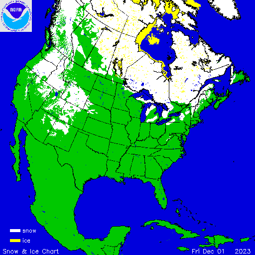

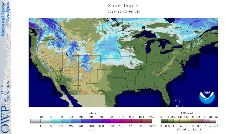
Approximately 16 percent of the contiguous U.S. (CONUS) was covered by snow at the beginning of December according to NOAA's National Snow Analysis. At the beginning of the month, snow covered much of the mountainous West, Northeast and parts of the central Plains and Great Lakes. Snow cover decreased steadily over the subsequent week before a storm brought snow to much of the mountainous West and Northeast and parts of the northern Plains, Great Lakes and along the Appalachian Mountains, increasing the snow coverage to approximately
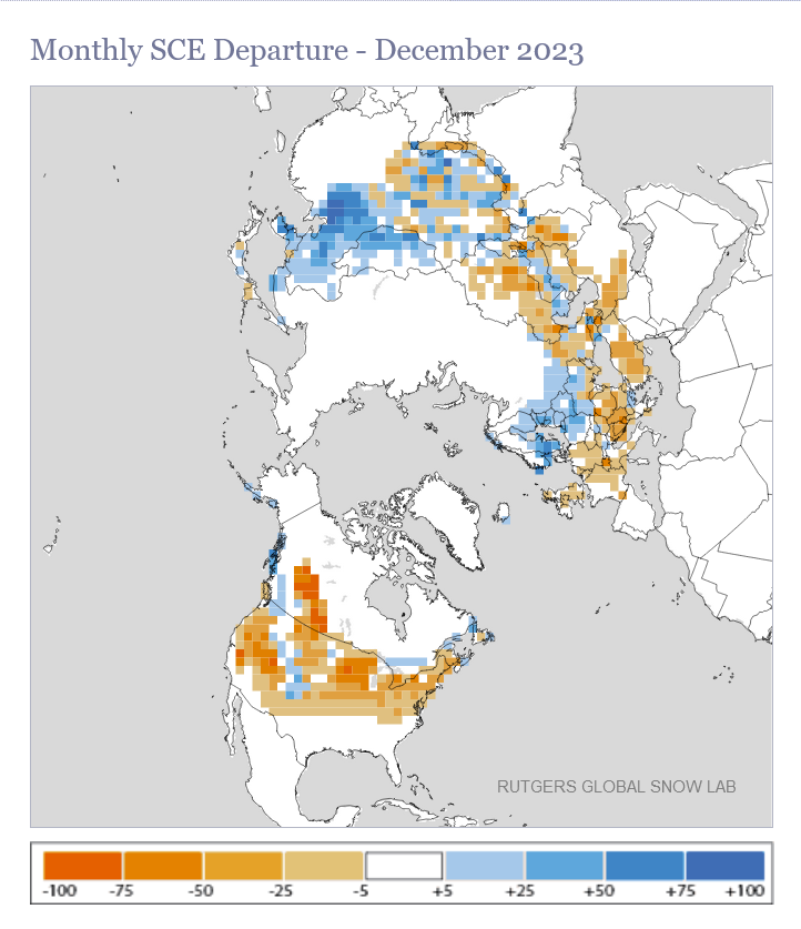
According to NOAA data analyzed by the Rutgers Global Snow Lab, the December snow cover extent was 642,000 square miles, 539,000 square miles below the 1991-2020 average, and the 3rd-lowest value in the 58-year satellite record. Below-average snow cover was observed across much of the contiguous U.S., while above-average snow cover was observed from parts of the central Plains to the northern Rockies and in portions of the Northwest.
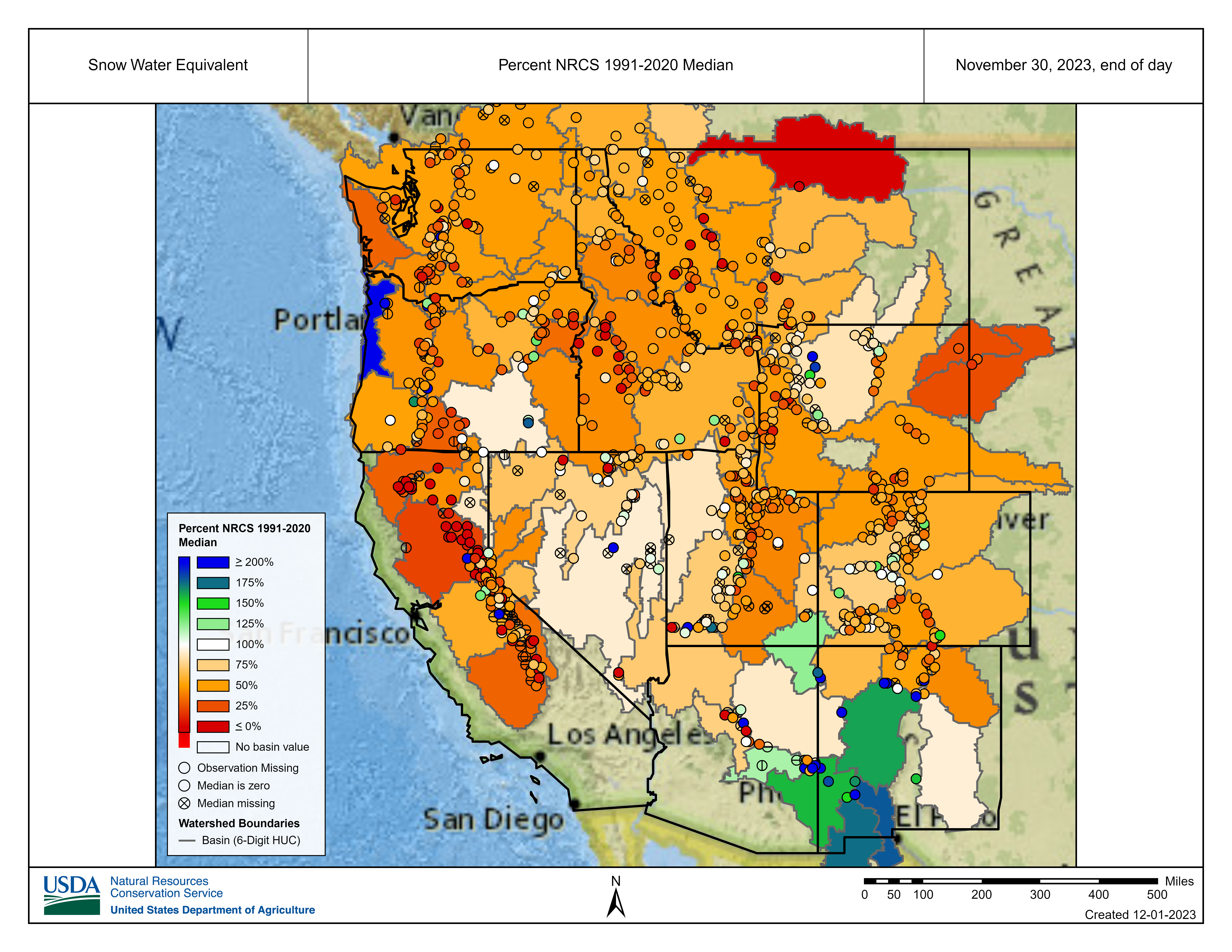
Melting of winter and spring mountain snowpack provides a crucial summer water source across much of the western United States. The total annual water budget for agriculture and human use in the mountainous West is highly dependent on the amount of snow melt that will occur in spring and is proportional to the amount of snow on the ground, which can be approximated by a measure of the snow water equivalent (SWE).
On November 30, SWE values were below normal across most of the West, while portions of the Oregon Coast and lower Southwest region observed above-normal SWE values during the month. By the end of December, SWE values were below normal across almost the entire West, while parts of the Oregon Coast and southern New Mexico observed above-normal SWE values at the end of the month.