Use the form below to select from a collection of monthly summaries recapping climate-related occurrences on both a global and national scale.
National Snow and Ice ReportDecember 2021
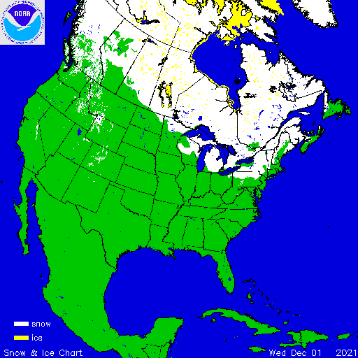
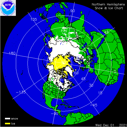
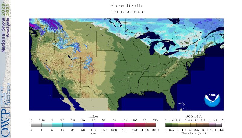
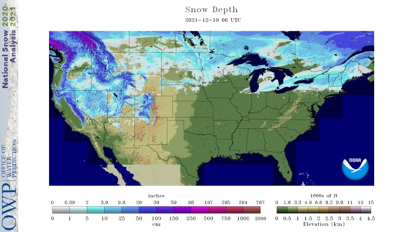
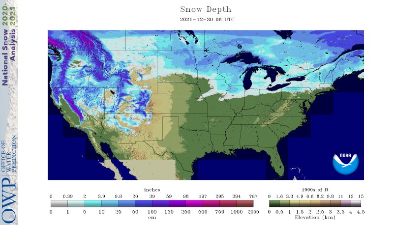
Approximately 10 percent of the contiguous U.S. (CONUS) was covered by snow at the beginning of December according to NOAA's National Snow Analysis. Snow blanketed the highest elevations of the Rocky Mountains and from northern Minnesota to the northern Great Lakes and into the Northeast. The minimum extent for the month—6.0 percent—occurred on the 3rd, prior to several notable winter storm events. One such event peaked on the 11th with nearly 30 percent snow cover across much of the mountainous West, northern Plains, Midwest, Great Lakes and from the Appalachians to New England. Snow cover remained steady over the next week and increased to more than 31 percent by the 19th. Snow cover across the northern Plains, Midwest, Great Lakes and Northeast remained intact throughout the remainder of the month. On December 30, snow cover peaked for the month with 40.2 percent coverage. Several strong atmospheric river events impacted the West Coast and brought nearly 18 feet of snow to portions of the Sierra Nevada Range at the Central Sierra Snow Laboratory near Donner Summit, CA. This series of intense storms brought significant snows to the southern Cascades and Sierras, reporting well-above-average snowpack by the end of the month.
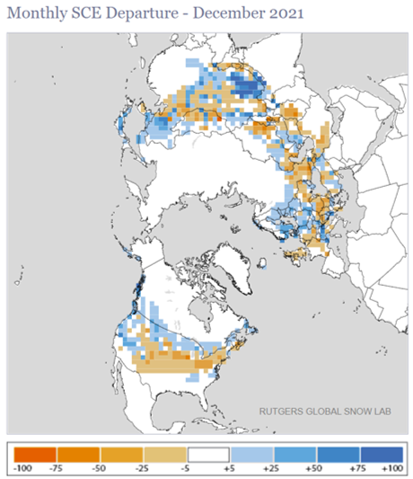
According to NOAA data analyzed by the Rutgers Global Snow Lab, the December snow cover extent was 108,000 square miles, 97,000 square miles below the 1981-2010 average. This was below the 30-year mean and the 14th-lowest value in the 55-year satellite record. Above-average snow cover was observed across much of the Cascades, northern Sierras, portions of the Great Basin, northern Rockies, northern Plains and northern Great Lakes. Below-average snow cover was observed from the central and southern Rockies to the southern Great Lakes and into the Northeast.
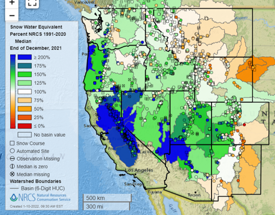
Melting of winter and spring mountain snowpack provides a crucial summer water source across much of the western United States. The total annual water budget for agriculture and human use in the mountainous West is highly dependent on the amount of snow melt that will occur in spring and is proportional to the amount of snow on the ground, which can be approximated by a measure of the snow water equivalent (SWE).
On November 30, SWE values across much of the western U.S. were less than 75 percent of median with many locations below 25 percent. By the end of December, SWE values were at or above 100 percent across most of the region with portions of the Cascades, Sierras and Great Basin reporting SWE values in excess of 200 percent of median. Portions of the northern Cascades, northern Rockies and front range of the central and southern Rocky Mountains had SWE values 75 percent of median or less at the end of December.