Use the form below to select from a collection of monthly summaries recapping climate-related occurrences on both a global and national scale.
National Snow and Ice ReportOctober 2005
National Snow and Ice
National Snow and Ice
National Snow and Ice
National Snow and Ice
National Snow and Ice
National Snow and Ice
National Snow and Ice
National Snow and Ice
National Snow and Ice
National Snow and Ice
National Snow and Ice
National Snow and Ice
National Snow and Ice
National Snow and Ice
National Snow and Ice
National Snow and Ice
National Snow and Ice
National Snow and Ice
National Snow and Ice
National Snow and Ice
National Snow and Ice
National Snow and Ice
National Snow and Ice
National Snow and Ice
National Snow and Ice
National Snow and Ice
National Snow and Ice
National Snow and Ice
National Snow and Ice
National Snow and Ice
National Snow and Ice
National Snow and Ice
National Snow and Ice
National Snow and Ice
National Snow and Ice
National Snow and Ice
National Snow and Ice
National Snow and Ice
National Snow and Ice
National Snow and Ice
National Snow and Ice
National Snow and Ice
National Snow and Ice
National Snow and Ice
National Snow and Ice
National Snow and Ice
National Snow and Ice
National Snow and Ice
National Snow and Ice
National Snow and Ice
National Snow and Ice
National Snow and Ice
National Snow and Ice
National Snow and Ice
National Snow and Ice
National Snow and Ice
National Snow and Ice
National Snow and Ice
National Snow and Ice
National Snow and Ice
National Snow and Ice
National Snow and Ice
National Snow and Ice
National Snow and Ice
National Snow and Ice
National Snow and Ice
National Snow and Ice
National Snow and Ice
National Snow and Ice
National Snow and Ice
National Snow and Ice
National Snow and Ice
National Snow and Ice
National Snow and Ice
National Snow and Ice
National Snow and Ice
National Snow and Ice
National Snow and Ice
National Snow and Ice
National Snow and Ice
National Snow and Ice
National Snow and Ice
National Snow and Ice
National Snow and Ice
National Snow and Ice
National Snow and Ice
National Snow and Ice
National Snow and Ice
National Snow and Ice
National Snow and Ice
National Snow and Ice
National Snow and Ice
National Snow and Ice
National Snow and Ice
National Snow and Ice
National Snow and Ice
National Snow and Ice
National Snow and Ice
National Snow and Ice
National Snow and Ice
National Snow and Ice
National Snow and Ice
National Snow and Ice
National Snow and Ice
National Snow and Ice
National Snow and Ice
National Snow and Ice
National Snow and Ice
National Snow and Ice
National Snow and Ice
National Snow and Ice
National Snow and Ice
National Snow and Ice
National Snow and Ice
National Snow and Ice
National Snow and Ice
National Snow and Ice
National Snow and Ice
National Snow and Ice
National Snow and Ice
National Snow and Ice
National Snow and Ice
National Snow and Ice
National Snow and Ice
National Snow and Ice
National Snow and Ice
National Snow and Ice
National Snow and Ice
National Snow and Ice
National Snow and Ice
National Snow and Ice
National Snow and Ice
National Snow and Ice
National Snow and Ice
National Snow and Ice
National Snow and Ice
National Snow and Ice
National Snow and Ice
National Snow and Ice
National Snow and Ice
National Snow and Ice
National Snow and Ice
National Snow and Ice
National Snow and Ice
National Snow and Ice
National Snow and Ice
National Snow and Ice
National Snow and Ice
National Snow and Ice
National Snow and Ice
National Snow and Ice
National Snow and Ice
National Snow and Ice
National Snow and Ice
National Snow and Ice
National Snow and Ice
National Snow and Ice
National Snow and Ice
National Snow and Ice
National Snow and Ice
National Snow and Ice
National Snow and Ice
National Snow and Ice
National Snow and Ice
National Snow and Ice
National Snow and Ice
National Snow and Ice
National Snow and Ice
National Snow and Ice
National Snow and Ice
National Snow and Ice
National Snow and Ice
National Snow and Ice
National Snow and Ice

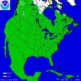
The two satellite-derived images above show the daily snow cover across the Northern Hemisphere (left map) and North America (right map) throughout October 2005. The maps show snow cover on October 1st, illustrating the beginning of the snow pack in the northern latitudes. By clicking on the images, the gradual expansion of snow and ice cover is shown and by the end of the month, much of Siberia as well as Alaska and northern Canada are snow covered. Arctic sea-ice also increases throughout October. For the U.S., snow cover resulting from an early season snow event is shown in the northern Great Plains on October 6th, and in Colorado on October 11th. Billings, MT set a new record for daily October snowfall with nearly 10 inches on the 5th, while the greater Denver area in Colorado received over 10 inches on the 10th.
More information on significant winter weather and other hazards can be found on NCDC's Hazards page.

The map to the left depicts snow depth across the Northeast for the morning of October 26th, 2005. Snowfall associated with an early season Nor'easter and augmented by moisture from Hurricane Wilma several hundred miles off the coast, fell on October 25th, leaving over 6 inches of accumulation in some areas. The Nor'easter followed two storms earlier in the month that produced torrential rain causing localized flooding. In New Hampshire, Mount Washington's October snowfall record was shattered, with 78.9 inches falling in October 2005, compared with 39.8 inches in October 2000. More information on October severe winter weather can also be found on NCDC's Hazards page.