| Severe to exceptional
drought
continued throughout much of the western United States, with
limited relief confined to the narrow coastal margin of California,
Oregon and Washington. |

larger
image
|
 larger
image
|
Drought persisted in
southeast Australia, particularly New South Wales and Victoria
during early February 2003. In New South Wales, 97 percent of the
province was in the grip of severe rainfall shortages, with 71
percent of the country as a whole in severe drought (Australian
Bureau of Meteorology). |
| Numerous wildfires
continued to burn across parts of New South Wales in early
February, aggravated by the unusually dry conditions. |

larger
image
|
| While much of
southeastern Australia received beneficial
rains during the last half of February, long-term deficiencies
continued as December-February rainfall in Sydney was less than
half the normal amount. |

larger
image
|
In Somalia, maximum temperatures on the 2nd soared to 38°C
(100°F) in Burao, which is over 10°C (18°F) above
normal.
| In North Africa, a
dust storm affected Libya around the 6th, with a large plume of
airborne dust transported northward over the Mediterranean
Sea. |

larger
image
|

 Click for
Animation
|
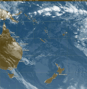
The remnants of
Tropical Cyclone Beni moved into
northeastern Australia on the 5th and produced locally heavy
rainfall. Across coastal
areas of Queensland, as much as 30 cm (12 inches) of rain fell
which brought flooding to areas around Rockhampton (Associated
Press). |
| In the Indonesian
capital of Jakarta, heavy rains on the 13th caused flooding that
affected 10,000 homes and produced traffic chaos throughout the
city. Flooding and landslides throughout the country killed around
60 people since December 2002 (Associated Press). |

larger
image
|
 larger
image
|
Heavy rainfall in
portions of Mozambique during early February produced flooding that
left about 100,000 families homeless, destroyed crops and severely
damaged roads and bridges (Associated Press). A period of above
normal rainfall that began in late January from the remnants of
Tropical Cyclone Delfina continued in February. |
| In Pakistan, heavy
rain and snow produced flooding around the17th that was responsible
for more than 60 deaths (BBC News). In Balochistan province, flash
flooding washed away parts of roads and highways. |

larger
image
|
In neighboring Afghanistan, heavy rain and snow alleviated
long-term drought conditions. Winter precipitation in parts of
Afghanistan and Pakistan was the heaviest in the last 5 years.
| Despite above normal
precipitation during the month of February, winter precipitation
remained subnormal in the capital city of Kabul. |

larger
image
|
 larger
image
|
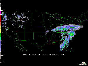
Heavy rainfall
associated with the same storm system that brought very heavy
snowfall to the eastern seaboard of the United States during
February 15-17 also caused severe
flooding in eastern Kentucky. Numerous rivers rose above flood
stage, causing flooding in many communities. |
For an archive of flood events worldwide, see the
Dartmouth Flood Observatory.

| A tornado that was
responsible for over 100 deaths struck remote areas of the central
Democratic Republic of Congo on the 2nd, affecting 6 villages in
the District of Yumbi, Bandundu province (Associated Press). The
tornado injured another 1,700 people, more than 200 critically, as
it impacted an area located about 250 km (150 miles) northeast of
the capital of Kinshasa (Associated Press). |

larger
image
|
In western India, severe thunderstorms on the 18th in the town
of Dholatar in Gujarat state
destroyed 28 houses, killing at least 5 people (CIP report).
The storm also disrupted power in region, knocking down nearly
11,000 power poles.

| Tropical Cyclone
Japhet developed off the west coast of Madagascar on the 26th and
was located over the Mozambique Channel on the 27th with maximum
sustained winds near 110 km/hr (60 knots or 70 mph). |

larger
image
|
 larger
image
|
Tropical Cyclone
Fiona pushed
south of Java during the 5th-6th, but locally heavy rains fell on
the island. Maximum sustained winds with the cyclone reached as
high as 185 km/hr (100 knots or 115 mph) over open waters of the
Indian Ocean on the 8th-9th. |
| Tropical Cyclone
Gerry
developed off the northeast coast of Madagascar on the 9th and was
located just north of the Mascarene Islands on the 13th with
maximum sustained winds of 185 km/hr (100 knots or 115 mph). Over
178 mm (7 inches) of rain had fallen on Reunion Island on the 13th
as Gerry passed to the northeast of the island. Meanwhile, Tropical
Cyclone Hape was located farther to the east over open Indian Ocean
waters and dissipated by the 15th. |

larger
image
|
 Click
for Animation
|
A Pacific storm system
moved into the Southwest U.S. during February 11-13th, dumping
heavy rains on parts of southern California eastward into adjacent
areas of Nevada and Arizona. After a 6-week dry spell, up to 178 mm
(7 inches) of rain fell on parts of southern California which broke
some daily rainfall records and caused localized flooding. At Las
Vegas, Nevada, 19 mm (0.74 in) of rain fell on the 12th, which was
the 3rd wettest calendar day since November 21, 1996. |
Another weather system tracked into the U.S.
Southwest during the 25th-26th, bringing locally heavy rain and
mountain snow to parts of the Four Corners region.

A winter storm swept across the U.S. southern plains during the
24th-25th, with ice and snow across north Texas and
from Oklahoma eastward into Arkansas and southern Missouri. At
least 15 people were killed in the region due to adverse winter
weather (Reuters).
| In Canada, cold
temperatures in Newfoundland froze floodwaters which affected the
town of Badger. The Exploits, Red Indian and Badger rivers flooded
the town as ice jams gave way on the 15th. By the 17th,
temperatures as low as -20°C (-4°F) froze much of the
standing water, encasing cars, snowmobiles and some homes in ice.
Most of Badger's 1,100 residents were evacuated during the 15-16th
after a state of emergency was declared (Associated Press). |

larger
image
|
In eastern Canada, freezing rain that affected New Brunswick on
the 2nd caused thousands of power outages, and cost the provincial
electrical utility New Brunswick Power between $3-4 million (USD)
in damage repair (Canadian Press). A power company spokesman
characterized the ice storm as the worst in the utility's history,
eclipsing the cost of the 1998 ice storm in New Brunswick.
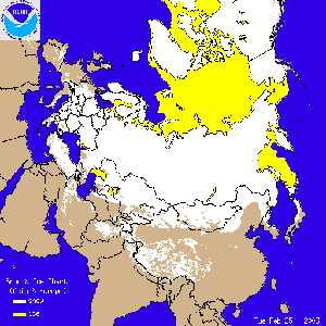
 Europe/Asia Snow Cover Loop
|
A winter storm brought
heavy snow to parts of Jordan, Israel and Lebanon during the
24-26th and was characterized as the heaviest snowfall since 1950
for parts of the region. Locally over 20 cm (8 inches) of snow
accumulated, disrupting transportation and closing schools and
business throughout the area. Snowfall
across interior Europe was unusually heavy during late February
2003. |
References:
Basist, A., N.C. Grody, T.C. Peterson and C.N. Williams, 1998:
Using the Special Sensor Microwave/Imager to Monitor Land Surface
Temperatures, Wetness, and Snow Cover. Journal of Applied
Meteorology, 37, 888-911.
Peterson, Thomas C. and Russell S. Vose, 1997: An overview of
the Global Historical Climatology Network temperature data base.
Bulletin of the American Meteorological Society,
78, 2837-2849.
|


 NOAA's National Centers for Environmental Information


