SPECIAL SNOW REPORT 2/18/03
Northeastern Snow Storm 2/16/03-2/17/03
 Larger image
 |
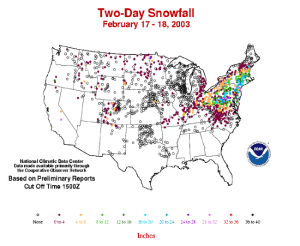
One of the largest snowstorms in many years brought paralyzing snow accumulations to the Northeast over the President's Day weekend (16th-17th February). The image to the left shows the snowfall totals for stations across the Northeast U.S for the 48 hours beginning at 7am (Eastern Standard Time) on the 16th until 7am on Tuesday 18th. Over 2 feet (61 cm) of snow fell in many locations (mainly on the 17th), with the major northeastern cities of Washington DC, New York City and Boston coming to a standstill while roads were cleared. |
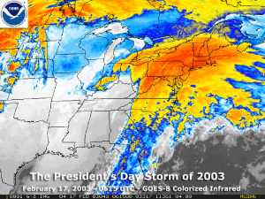
| The infrared satellite image to the right shows the storm as it tracked across the northeastern states on the 17th. The National Weather Service 24-hour snow totals can be seen by clicking to several text files of station data for many locations across New England, New York and New England and the mid-Atlantic. |
 Larger image |
 Larger image
 |
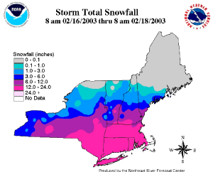
The image to the left
from NOAA's National Weather Service Northeast River Forecast
Center shows snowfall totals in the Northeast for the snow
event on the 16th and 17th February 2003. Well over a foot (30.5
cm) of snow fell across almost the entire state of Massachusetts,
and much of the rest of southern New England and New York. However,
the storm covered in snow an area from Kentucky to Connecticut on
the 16th and 17th and at least 10 deaths have been attributed to
the storm (Reuters). Some of the largest accumulations from the
President's Day Storm occurred in and around New York City with
Central Park receiving 19.8 inches (50.3cm) from the storm. This
makes February 2003 the fourth snowiest February in Central Park
with the total so far (as of the 18th) standing at 26.1 inches
(66.3 cm) for February 2003. This total is also nearing the
snowiest month of all time which was March 1896 with 30.5 inches
(77.5 cm). Boston received a remarkable 27.5 inches (69.9 cm) of
snow - the largest snowfall total for any storm in the city since
records began. |
The storm left
portions of the Southeast contending with ice and sleet instead of
snow, and travel conditions were dangerous across large portions of
the Carolinas and Georgia over the President's Day weekend. Airport
delays across the entire eastern seaboard left thousands of
travelers stranded over the Sunday 16th-Tuesday 18th period.Other Snow information for February: |
 Larger image
 |
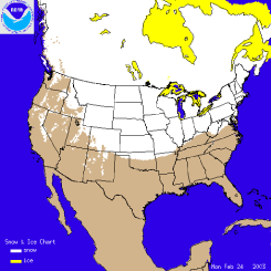
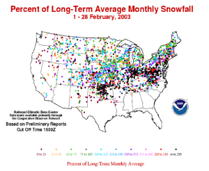
February 2003 was a
snowy month for many locations especially in the eastern U.S. A
series of winter storms brought snow to parts of the Northeast and
Mid-Atlantic through the month, with the President's Day storm of
the 16th and 17th of February being by far the most notable for the
month and season in the Northeast. Oklahoma and parts of Missouri
and Kansas have seen much above average snow for February (see map
to the left) and the
winter season. The Ohio Valley has also had a snowier than
average February. Western snowpacks have also received some more
snow this month, though
most areas still remain below average for the season. |
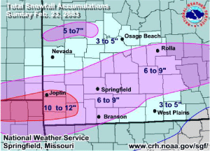
As much as a foot of snow fell on parts of southern Missouri and southeastern Kansas (see map to the right) on Sunday 23rd of February. The same storm left as much as 10-20 inches (25-50 cm) of snow in northern Oklahoma causing a 75 car pile-up on Interstate 44 (AP). The seasonal total for Springfield, MO through the end of February 2003 was around 35 inches (89 cm). The average seasonal total up to the end of February is less than 17 inches (43 cm), placing 2003 as the 4th snowiest season so far for Springfield. See NOAA's National Weather Service Forecast Office web-page for Springfield, Missouri for further information on this and other storms for the region. |
 Larger image
 |
 NOAA's National Centers for Environmental Information
