
The Fleet Numerical Meteorology and Oceanography Center (FNMOC) global-scale operational ocean prediction system produces daily ocean forecasts based on the Navy Global Hybrid Coordinate Ocean Model (HYCOM). Navy HYCOM is the successor to the Global Navy Coastal Ocean Model (NCOM), and provides boundary conditions to Navy regional models such as AMSEAS and USEAST . The system is also run by NOAA, with different atmospheric forcing, as the Global Real-Time Ocean Forecast System (Global RTOFS).
Access Methods
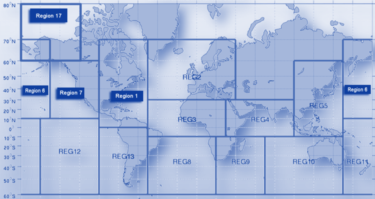
This site provides access to data for regions covering U.S. coastal waters, as well as a global surface model.
For operational, 24/7/365 access to updates of this product, consider using the high-availability servers at the NCEP. These provide access to Global Real Time Ocean Forecast System (RTOFS) data derived from HYCOM. This data and other ocean products are also available through the Ocean Prediction Center.
| Product | Grid/Scale | POR | Model Cycle | Output Time Step | Access |
|---|---|---|---|---|---|
| Region 1 | 1/12° | 2013-02-27–Present | 1 day | 3 hours | |
| Region 6 | 1/12° | 2013-03-05–Present | 1 day | 3 hours | |
| Region 7 | 1/12° | 2013-03-05–Present | 1 day | 3 hours | |
| Region 17 | 1/12° | 2013-03-05–Present | 1 day | 3 hours | |
| Global Surface | 1/12° | 2013-03-05–Present | 1 day | 3 hours |
Specifications
Navy Global HYCOM is produced once a day, with a forecast range of 7 days. All input data are assimilated using the NRL-developed Navy Coupled Ocean Data Assimilation (NCODA) system.
Output Data
- Variables: Ocean temperature, salinity, eastward and northward currents, elevation
- Horizontal Resolution: 1/12°
- Vertical Resolution: 40 standard depth levels
- Frequency: Daily, at 00Z
- File Format: NetCDF
Input Data
- Satellite altimeter observations
- Satellite and in situ sea surface temperature
- In situ vertical temperature and salinity profiles from XBTs, ARGO floats, and moored buoys


