
NCEI works with NOAA Ocean Exploration to ensure that ocean exploration data collections are available to the public, and align with FAIR (Findable, Accessible, Interoperable, Reusable) principles through careful stewardship of vital sonar, oceanographic, imagery, video, and collected specimen information. These collections contribute greatly to scientific understanding of the world’s ocean.
The NOAA Ocean Exploration Data Management Team at NCEI performs cutting-edge end-to-end data management for NOAA Ocean Exploration-sponsored missions, partnerships, and projects, including expeditions aboard NOAA Ship Okeanos Explorer.
These efforts enable rapid and easy data access, facilitate efficient and effective long-term data preservation, and inspire further ocean exploration and research.
NOAA Ocean Exploration Data Products and Services
Interactive maps, access portals, and other tools for accessing data collected, developed, and funded by NOAA Ocean Exploration.
NOAA Ocean Exploration Data Atlas (New Version)
The new NOAA Ocean Exploration Data Atlas uses the latest GIS technologies to provide access to a continuously updated archive of data, information, and products. The map includes search filters for expedition location, collection year, vessel name, platform type, and open text. Expeditions are displayed on a map and organized by year and location. Ship and ROV tracklines and data points include access to expedition websites, data, and publications. To provide feedback on this new map viewer, please email OER.info.mgmt@noaa.gov.
Okeanos Explorer Expeditions
This site lists and describes NOAA Ship Okeanos Explorer expeditions, and provides direct access to corresponding data and products.
NOAA Ocean Exploration Funded Expeditions
This site lists and describes some of the expeditions funded by NOAA Ocean Exploration through its Notice of Funding Opportunity, and provides direct access to corresponding data and products.
NOAA Ocean Exploration Video Portal
This portal provides access to thousands of hours of underwater video data collected by deep submergence vehicles. Features include a keyword enabled search, low-resolution previews of clips discovered by search criteria, and high-resolution video downloads. Additionally, the portal provides access to critical video metadata which may include dive summaries, expedition summaries, and other associated content.
Benthic Deepwater Animal Identification Guide
A collection of images assembled as a taxonomic reference of deepwater animals encountered by remotely operated vehicles (ROVs) deployed from NOAA ship Okeanos Explorer. The guide is currently limited to observations from U.S. marine protected areas in the central and western Pacific Ocean.
Okeanos Explorer - Live Operations Map
This live operations web map tracks the operations of the Okeanos Explorer in near real time, and shares the ship's current location, the current cruise’s ship track, and daily bathymetric products.
Data Request Form
Use this form to contact the NOAA Ocean Exploration Data Management Team at NCEI for assistance in locating specific NOAA Ocean Exploration data or information.
ArcGIS Online Services
The NOAA Ocean Exploration Data (NCEI) ArcGIS Online Group provides access to all NCEI-managed NOAA Ocean Exploration data services. This group includes all data layers found within the Okeanos Explorer - Live Operations Map, the new NOAA Ocean Exploration Data Atlas, and more. Check this group regularly as NCEI develops more NOAA Ocean Exploration GIS data services.
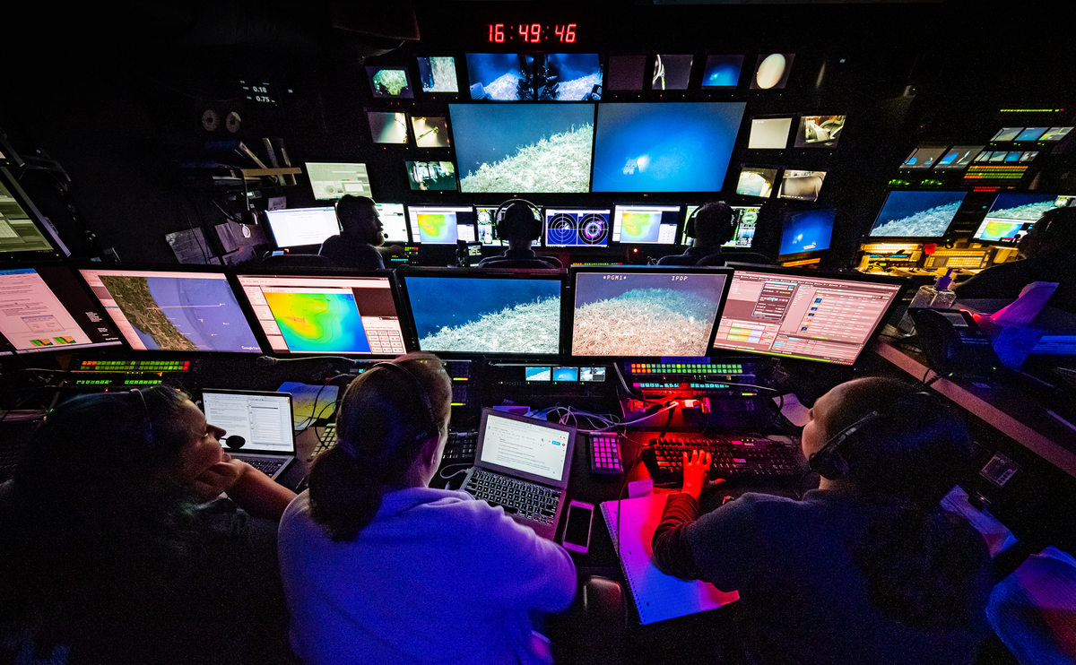
About Video Data Management
NOAA Ocean Exploration uses remotely operated vehicles (ROVs) to collect roughly ~45TB, or ~1000+ hours, of underwater video each field season. These high definition videos provide crucial insight into habitats and environmental conditions unobtainable from other sources alone. Video and related products captured by the NOAA Ship Okeanos Explorer (2010 to present) make up the majority of NOAA Ocean Exploration’s data holdings. In 2014, the NOAA Ocean Exploration Data Management Team at NCEI began investigating contemporary video data annotation methods, short- and long-term storage systems, and data access options. Better known as the Video Data Management Modernization Initiative (VDMMI), this four-year-long investigation included a broad spectrum of activities:
- Participation in the NOAA cloud pilot project
- Participation in the Federal Agency Digital Guidelines Initiative (FADGI) study
- Documentation of best practices (including extensible ISO 19115-2 metadata templates)
- Completion of automated data load and extraction systems
- Development of a video data discovery and access portal
This work culminated in the successful implementation of a modern, end-to-end video management system that provides direct online access to the complete collection of the Okeanos Explorer digital video data.
As new data collection technologies emerge and datasets grow larger, the NOAA Ocean Exploration Data Management Team at NCEI will continue to refine, adapt, and innovate new data management capabilities, ensuring prompt and enduring access to NOAA Ocean Exploration video information.

Although NCEI’s video data management system was created specifically for video captured by ROVs onboard the NOAA Ship Okeanos Explorer, certain elements are applicable, and have been applied, to other underwater video data collections. The team continues to digitize, archive, and make the legacy NOAA Ocean Exploration video (1999-2010) accessible; the resulting video data management guidance may aid in managing other legacy video collections.
Contact the NOAA Ocean Exploration Data Management Team at NCEI to discuss our video data inventory management solutions.
Related Sites, Organizations, and Documentation
Guidance Documents
-
Guidance for Data Inclusion in NOAA Ocean Exploration ArcGIS Online Geospatial Services
-
Information for NOAA Ocean Exploration funded data collected by Notice of Funding Opportunity (NOFO) grantees and NOAA Ocean Exploration partners.
-
Best practices for a successful video data management system developed by the NOAA Ocean Exploration Data Management Team at NCEI.
-
Practical technical information for both file creators and file archivists. Led by the Library of Congress.
Reports and Papers
-
This document describes the project and seeks to inform others with video data inventories that need to be preserved.
-
Establishing Community Standards for Underwater Video Acquisitions Final Workshop Report
-
Workshop sponsored by the National Science Foundation (NSF) in June 2016 focusing on development of a community-driven strategy for managing underwater video data collections.
-
An evaluation of Hierarchical Data Format Version 5 (HDF5) as a storage model for archive and video data delivery.
-
The NOAA Central Library creates a quarterly report of summary-level bibliometric analysis on known peer-reviewed journal articles produced from research catalyzed by NOAA Ocean Exploration.
Metadata
-
Discussion of the importance of metadata to video data management.
-
An ISO 19115-2 formatted metadata template at the segment-level designed and refined by the NOAA Ocean Exploration Data Management Team at NCEI.
Websites
- NOAA Ocean Exploration Website
- NOAA Ocean Exploration Program Document Collection in NOAA's Institutional Repository


