
NCEI provides stewardship services, including quality control and initial analyses, for long term, high resolution observations of the ocean surface state collected by satellites and other remote sensing methods. These observations provide information about sea surface temperature changes, major currents and eddies along U.S. coasts, surface winds, sea surface height, ocean color, and other derived quantities that enhance our understanding of the ocean’s dynamic nature.
Products created by NOAA line offices.
Synthetic Aperture Radar (SAR) Derived Wind Products
High resolution sea surface winds data derived from SAR on-board RADARSAT-2 satellite.
MetadataQuality Monitoring Statistics
Satellite Sea Surface Salinity Monitor
Near real-time Sea Surface Salinity data products available from NOAA CoastWatch.
Chlorophyll Anomalies
Chlorophyll concentration provides an estimate of the live phytoplankton biomass in the surface layer. The chlorophyll anomaly is generated when today’s chlorophyll concentration data is compared to the bi-monthly mean. A positive anomaly indicates new algal growth.
Optimum Interpolation Sea Surface Temperature
The NOAA ¼ degree daily Optimum Interpolation Sea Surface Temperature (OISST) is an analysis constructed by combining observations from different platforms (satellites, ships, buoys) on a regular global grid.
Graphics
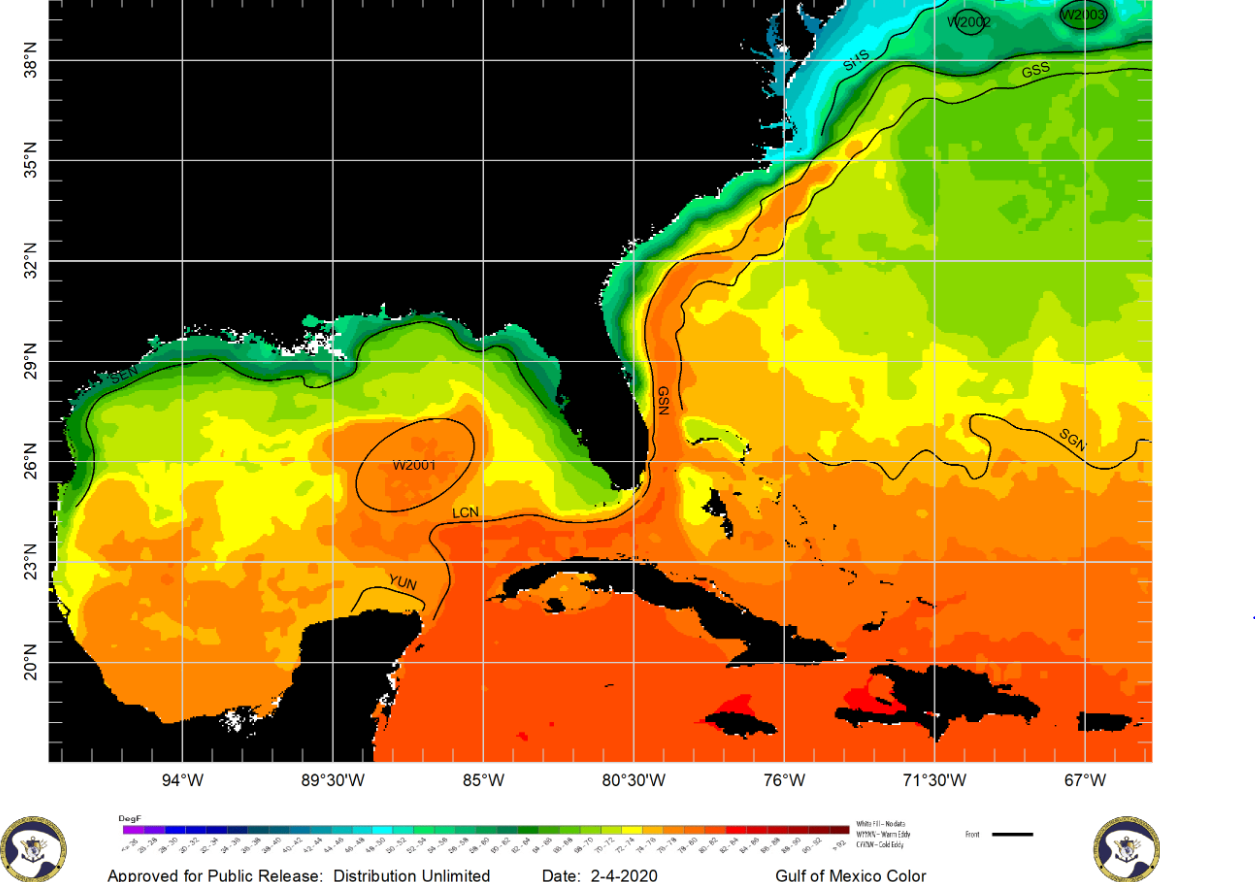
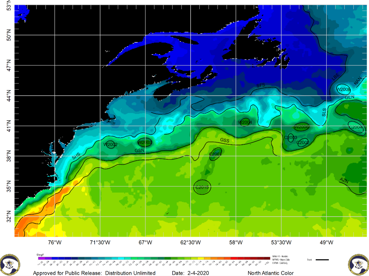
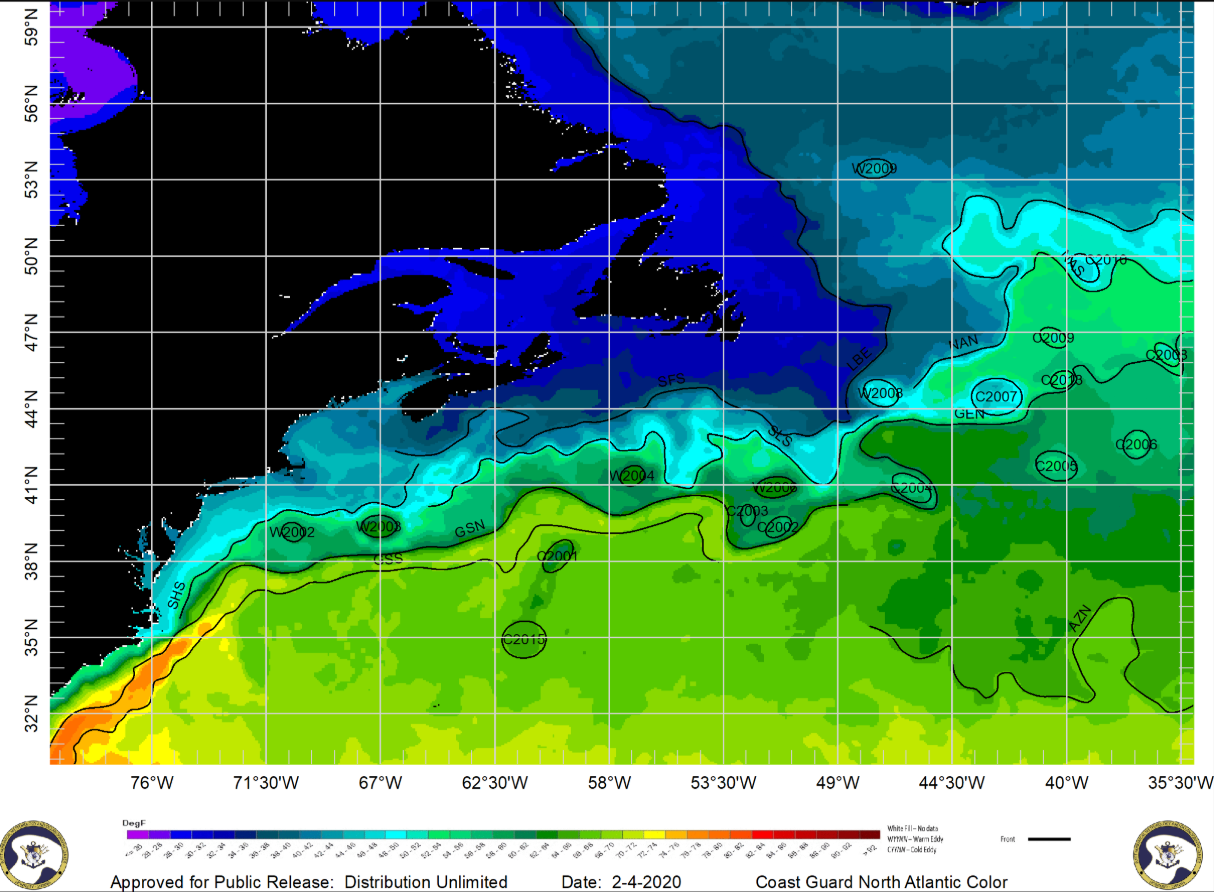
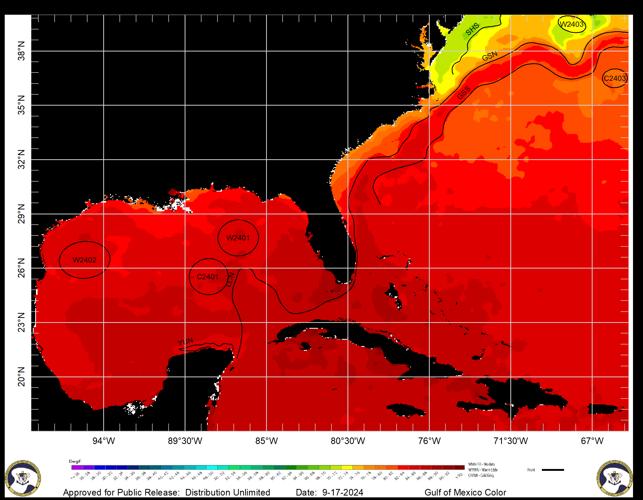
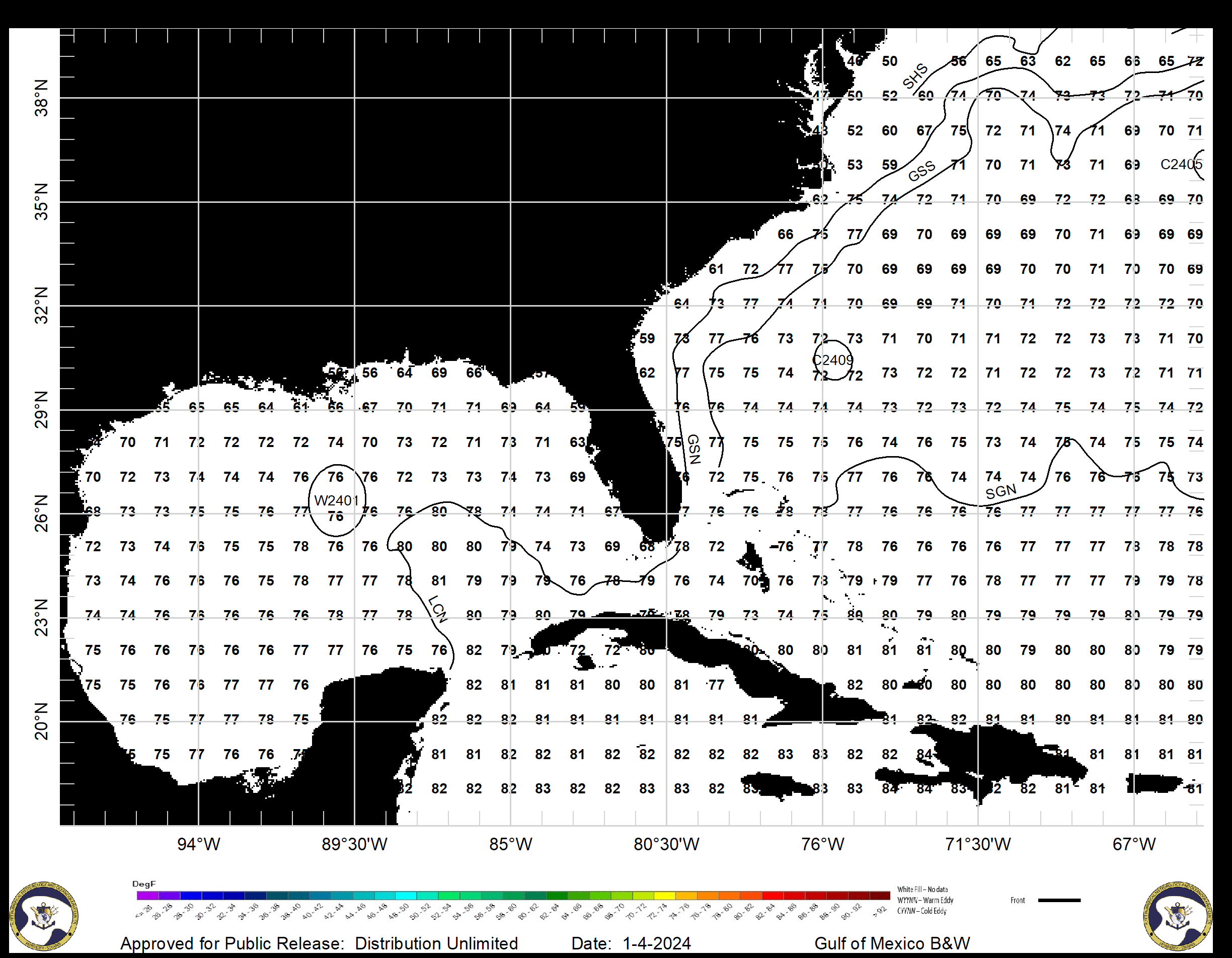
These files contain satellite sea surface temperature (SST) analyses for the Gulf of Mexico and Northern Atlantic that indicate a number of features. Graphics and text files are usually updated daily.
Text and Shapefiles
Downloadable files containing SST (°F) indicating fronts and eddies.
North Atlantic
Coverage Area:
30°N 73°W— 53°N 45°W


