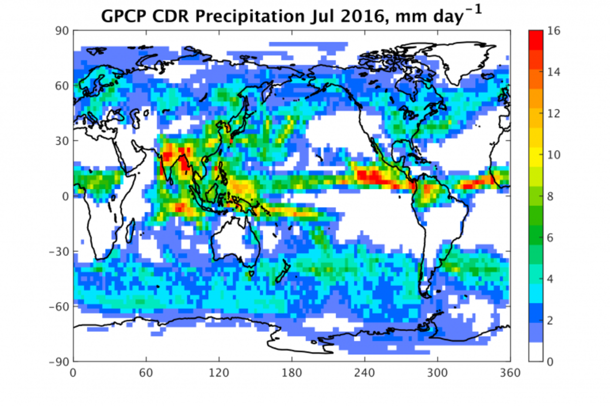
The Global Precipitation Climatology Project (GPCP) Monthly Precipitation Climate Data Record (CDR) consists of monthly satellite-gauge and associated precipitation error estimates taken from January 1979–present. The CDR is created by combining the precipitation information from several satellite and in situ sources into a final merged product that uses the strengths of each data type to create a more accurate record.
Passive Microwave estimates are based on Special Sensor Microwave Imager/Special Sensor Microwave Imager Sounder (SSMI/SSMIS) data; infrared precipitation estimates are included using Geostationary Operational Environmental Satellite (GOES) data and Polar-orbiting Operational Environmental Satellite (POES) data, as well as other low earth orbit data and in situ observations. Data are provided on a 2.5 degree grid.

To help the project receive continued support, updates, and improvement, tell us how you use Precipitation - GPCP Monthly CDR data by completing our optional User Registration Form.
Principal Investigator
Robert Adler, University of MD
Citation
Cite dataset when used as a source. See the dataset's landing page for citation details at doi:10.7289/V56971M6.

