

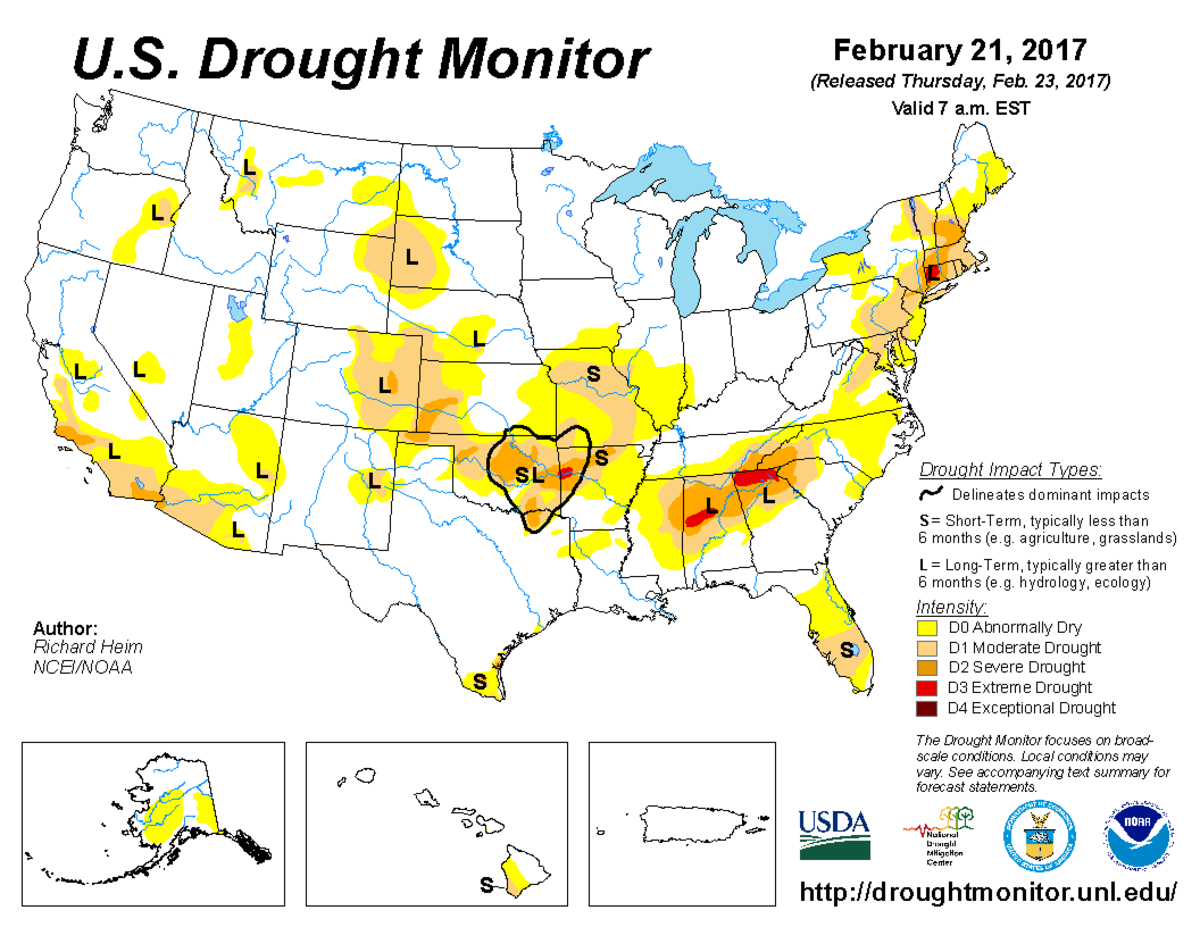
According to the February 21, 2017, U.S. Drought Monitor, moderate to extreme drought covers 13.8% of the contiguous United States, an increase from last week’s 13.5%. Areas of extreme drought remained generally unchanged. No areas were in exceptional drought, the worst category.
Drought contracted in California as Pacific weather systems continued to hammer the West Coast this U.S. Drought Monitor week, bringing over a foot of new precipitation to some stations in favored upslope areas. As they crossed into the Plains, a couple low pressure systems tapped Gulf of Mexico moisture to drop above-normal precipitation across parts of the Southern Plains and Lower Mississippi Valley, which contracted drought areas, as well as the Upper Mississippi Valley.
But, upper-level ridging over the central part of the contiguous United States kept temperatures warmer than normal for most of the country as well as bringing drier-than-normal weather to much of the Northern to Central Plains and most areas east of the Mississippi River. Drought expanded in the Southeast, where record to near-record low streamflows accompanied the warm and dry weather, as well as in parts of the Midwest.
The full U.S. Drought Monitor weekly update is available from Drought.gov.
In addition to Drought.gov, you can find further information on the current drought as well as on this week’s Drought Monitor update at the National Drought Mitigation Center. See their recent news releases.
The most recent U.S. Drought Outlook is available from NOAA’s Climate Prediction Center and the U.S. Department of Agriculture’s World Agriculture Outlook Board provides information about the drought’s influence on crops and livestock.
For additional drought information, follow #DroughtMonitor on Facebook and Twitter.


