|
Contents Of This Report: |

|
National Drought Overview
|
|
[top]
Detailed Drought Discussion
Overview
April 2011 was a wet and warm month (10th wettest and 39th warmest, based on data back to 1895) when weather conditions are averaged across the country. But this reflected regional extremes (monthly precipitation and temperature) which resulted from persistent weekly regional patterns of precipitation (weeks 1, 2, 3, 4) and temperature (weeks 1, 2, 3, 4) anomalies throughout the month. Drought conditions improved where beneficial rains fell in the Southeast and heavy rains inundated parts of the Ohio and Mid to Lower Mississippi valleys. But drought intensified over parts of Florida where below-normal rain occurred. Little to no rain fell over parts of the southern Plains and Southwest, where drought conditions deteriorated with nearly three-fourths (74 percent) of Texas and two-thirds (61 percent) of New Mexico falling in the extreme (D3) to exceptional (D4) USDM drought categories by May 3. September 2010 was the last month that Texas had above-normal precipitation on a statewide basis. April 2011 marked the latest in a string of very dry months for the Lone Star State, with March-April 2011, February-April 2011, and October 2010-April 2011 being the driest such periods in the 1895-2011 record. In Hawaii, agriculture has recovered enough from beneficial rainfall to reflect improved drought conditions, but nearly half (46 percent) of the state remained in moderate to extreme (D1-D3) drought. About 26 percent of the contiguous U.S. was experiencing moderate to exceptional (D1-D4) drought at the end of April, a drop of 2 percent compared to the end of March. But nearly 12 percent was in the extreme to exceptional (D3-D4) category, reflecting a steady rise in drought extent for these categories over the last ten consecutive weeks.

The U.S. Drought Monitor drought map valid May 3, 2011.
By the end of the month, the core drought areas in the U.S. included:
- a large area of moderate (D1) to exceptional (D4) drought across the Southwest and Southern Plains, extending into the Central Plains;
- areas of moderate to severe (D2) drought stretching along the Gulf Coast to the Mid-Atlantic States with patches of extreme drought (D3) in southern Florida and along the Mississippi Delta; and
- parts of Hawaii, where moderate to extreme drought persisted.
Synoptic Discussion
The  weather pattern over the contiguous United States during April 2011 consisted of a westerly flow with strong low pressure waves or troughs embedded in the flow. Some of the troughs formed deep low pressure systems with slow-moving cold fronts which generated heavy rain and severe weather, especially in the Midwest to Southeast. According to preliminary reports, April had 875 reports of tornadoes which caused over 350 deaths. The National Weather Service expected the confirmed tornado count to approach the previous all-time monthly record of 542 tornadoes which struck the U.S. in May 2003. There were over 2000 reports of hail damage and more than 3200 wind damage reports, with most of the damage occurring from the southern and central Plains to the Atlantic coast. Tornadoes were observed on two-thirds of the days of the month, with the biggest tornado outbreaks reported on the 14th-16th and 25th-27th.
A zonal storm track was associated with the westerly flow, resulting in above-normal precipitation across much of the northern half of the country and below-normal rainfall across the southern tier. By the end of the month, wet soils dominated the northern U.S. and dry soils much of the southern U.S., where intensifying drought and widespread wildfires plagued the Southern Plains. Texas had the 5th driest April in the 117-year record. The storm track repeatedly tapped Gulf of Mexico moisture in a southerly surface airflow that generated storm systems week after week over the Midwest (week 1-2-3-4). The resulting well-above-normal rainfall culminated in widespread record flooding in the Ohio Valley by the end of the month. Some areas received up to 20 inches of rain during the month, which is nearly half their normal annual precipitation. Six states (Illinois, Indiana, Kentucky, Ohio, Pennsylvania, and West Virginia) had the wettest April on record. Snow cover was confined to the northern areas and mountainous West, with record snowfall occurring in the Great Plains. Snow cover peaked on April 20th when 22 percent of the contiguous U.S. was snow covered, but the month ended with only 10 percent coverage. Based on monthly average snow cover extent, April 2011 ranked as the 8th snowiest April in the 45-year satellite record for the contiguous U.S., and 10th snowiest April for North America.
April temperatures averaged below normal across the northwestern half of the country and above normal from the southern Plains to the Northeast, reflecting a westerly circulation that extended further south -- but was stronger -- than normal. The 3 states in the Pacific Northwest (Washington, 2nd coldest; Oregon, 5th; Idaho, 10th) had the 10th coldest, or colder, April, while 9 states in the South and East ranked in the top 10 warmest category, with Delaware claiming the warmest April on record. The strong northwest-southeast contrast in temperature anomalies helped intensify the circulation and, thus, the storm systems. On a national scale, April 2011 ranked as the 39th warmest and 10th wettest April in the 1895-2011 record.
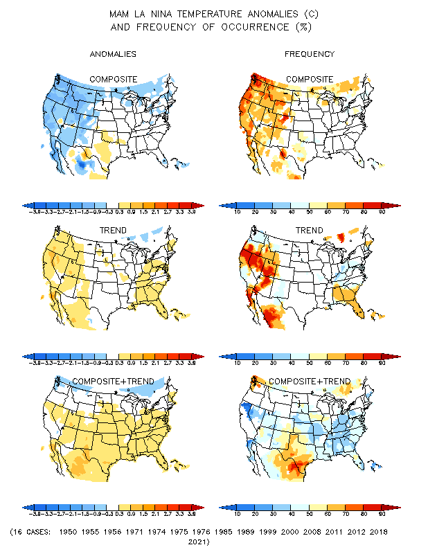
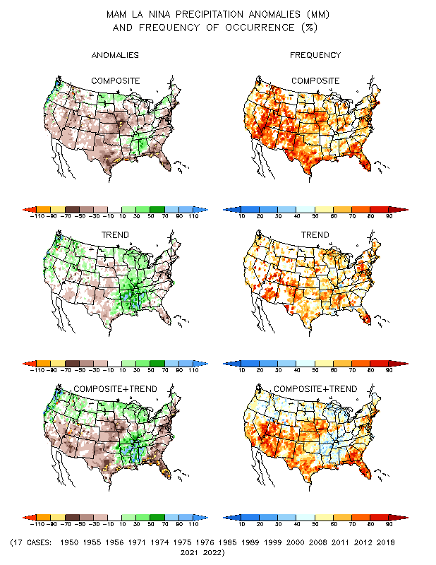
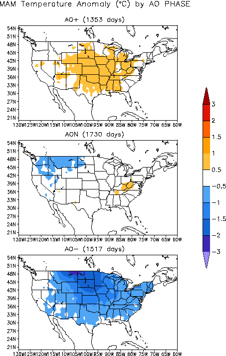
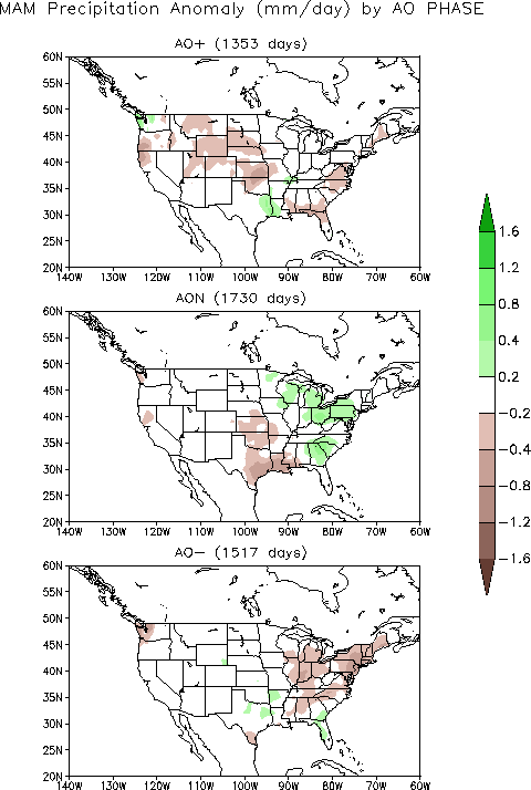
Cold fronts and low pressure systems moving in the storm track flow are influenced by the broadscale atmospheric circulation. Four such large-scale atmospheric circulation patterns were dominant during April. The first was a weakening La Niña, which is the phenomenon created by cooler-than-average sea surface temperatures in the eastern tropical Pacific Ocean. At this time of year, La Niña is typically associated with cold temperature anomalies in the Northwest, warm anomalies in the South, and dry anomalies across most of the country. The second atmospheric circulation index was the Pacific/North American (PNA) pattern, which was negative for most of the month. A negative PNA this time of year is typically associated with warmer-than-normal temperatures over the southeast third of the U.S. and colder-than-normal temperatures in the Northwest. Precipitation is not strongly correlated. The third atmospheric circulation index was the North Atlantic Oscillation (NAO) pattern, which was positive for most of the month. A positive NAO this time of year is typically associated with warmer-than-normal temperatures across most of the country and drier-than-normal conditions in the Southeast and parts of the central and western U.S. The fourth atmospheric circulation index was the Arctic Oscillation (AO) pattern, which also was positive for most of the month. A positive AO this time of year is typically associated with warmer-than-normal temperatures across the central U.S. and drier-than-normal conditions across parts of the central and southeastern U.S.
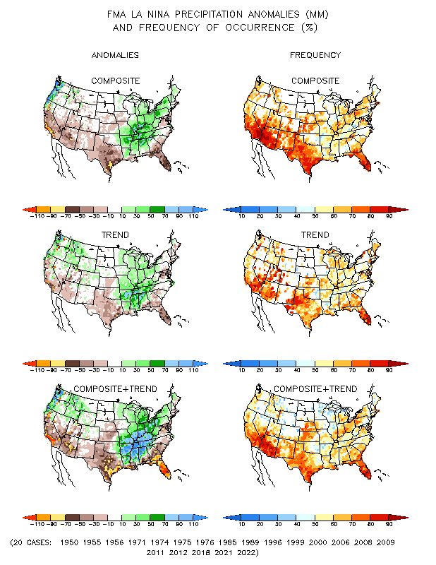
The pattern of observed temperature anomalies for April 2011 generally matched the La Niña and PNA patterns for April (mid-spring), with some correlation to the NAO and AO patterns. The April precipitation pattern generally matched the mid-spring La Niña, NAO, and AO patterns in the southern Plains and Southeast. For much of the country, the three-month (February-April 2011) precipitation pattern closely matched the corresponding pattern for La Niña. The April 2011 and February-April 2011 precipitation patterns also matched the mid-winter La Niña, PNA, and AO patterns.
Palmer Drought Index
|
 |
The Palmer drought indices measure the balance between moisture demand (evapotranspiration driven by temperature) and moisture supply (precipitation). The Palmer Z Index depicts moisture conditions for the current month, while the Palmer Hydrological Drought Index (PHDI) and Palmer Drought Severity Index (PDSI) depict the current month's cumulative moisture conditions integrated over the last several months. As seen on the Palmer Z Index map, low precipitation and hot temperatures resulted in short-term drought across much of the Southwest, Southern to Central Plains, and Gulf Coast, and parts of the Mid-Atlantic, during April 2011. Wet conditions are evident on the Z Index map over a large area from the Northeast and Great Lakes to Lower Mississippi Valley near Arkansas. Areas of the Northern Plains to Pacific Northwest were also wetter than normal. Compared with the March 2011 PHDI map, the April 2011 PHDI map indicates that drought conditions intensified in the Southwest and Southern Plains and parts of the Southeast; drought conditions contracted in the Ohio Valley and Middle and parts of the Lower Mississippi valleys; and moist conditions intensified in the Northeast, Ohio Valley, Great Lakes, and parts of the West. The April 2011 PHDI map also reflects the long-term nature of the drought conditions. The Z Index and PHDI maps in combination show that the dryness in the Southwest to parts of the Southeast is both a short-term and long-term phenomenon; that the wetness in the northern Plains and parts of the Rockies and Northeast is both a short-term and long-term phenomenon; and that the wetness in the Ohio Valley has been so extreme on the short-term (Z Index) that it is showing up in the long-term indicator (PHDI).
Standardized Precipitation Index
 |
 |
 |
The Standardized Precipitation Index (SPI) measures moisture supply. The SPI maps here show the spatial extent of anomalously wet and dry areas at time scales ranging from 1 month to 24 months. Dryness is evident across parts of California, the Southwest, Southern Plains, Gulf Coast, and Mid-Atlantic at the 1 month time scale. Severe to exceptional dryness stands out on the maps for the Southwest to Southern Plains at 2 and 3 months. The dryness in the Southwest and Southern Plains is still at severe to exceptional levels even at 6 to 9 months, and to a lesser extent at 12 months. Rainfall in recent months has improved conditions in the Southeast, but longer-term dryness is still evident there at the 6- to 12-month time scales. Only a few areas in the southern tier States are dry at the 24-month time scale. The exceptional wetness from Arkansas to the Northeast and Great Lakes dominates the 1- to 3-month maps. Exceptional wetness is also evident along the Pacific Coast at 2 months and in the northern High Plains to Upper Midwest at 9 to 12 months. In general, wetness dominates much of the West, northern States, and Midwest at most time scales, and spreads into the Southeast at 24 months.
 |
 |
 |
Agricultural Indices
 |
 |
Abnormal dryness and drought were evident in several indicators. There were hardly any days with precipitation across the Southern Plains, Southwest, Southern California, and parts of interior Washington State, as well as parts of Florida. This resulted in long runs of consecutive dry days in these areas. The dryness is also reflected in low total precipitation amounts and below-normal precipitation. On the other hand, it rained or snowed half or more of the days of the month along the coastal Pacific Northwest, parts of the Northern Rockies, and a large area from the Ohio Valley to the Northeast.
Soil moisture, both observed (USDA percent of top soil dry to very dry, and comparison to 5-year average and 10-year average) and as monitored by several models (NOAA Climate Prediction Center [CPC] anomalies and percentiles, Leaky Bucket, NLDAS [North American Land Data Assimilation System] top soil layer and total soil layer, VIC [University of Washington Variable Infiltration Capacity macroscale hydrologic model] percentiles, Palmer Crop Moisture Index), continued very dry from the Mid-Atlantic States to the Lower Mississippi Valley, with large areas of intense dryness across the Southwest to Southern and Central Great Plains, and a hint of dryness in parts of Alaska and Hawaii. Half or more of the topsoil moisture in Florida and Colorado was rated short to very short (dry to very dry), with two-thirds (64 percent) of the topsoil so rated in Oklahoma and 87 percent in New Mexico and Texas.
 |
 |
Satellite monitoring of vegetation health (Vegetation Drought Response Index [VegDRI], Vegetation Health Index [VHI]) indicated stress on vegetation continued across a wide swath covering the Mid-Atlantic, Southeast, Southern and Central Plains, and Southwest, especially over Texas. The USGS agro-hydrologic model (Soil Water Index, Water Requirement Satisfaction Index) indicated stress on vegetation along the Gulf Coast and from the Southern Plains to Southwest. According to May 1 USDA reports, roughly three-fourths of the pasture and rangeland in New Mexico and Texas was rated in poor or very poor condition, and about half so rated in Oklahoma. This is well above what is considered average and ranks as a record (based on 1995-2010 data) for this time of year. About three-fourths of the wheat crop was rated in poor to very poor condition in Oklahoma (77 percent), Texas (74 percent), and New Mexico (70 percent), and just under half so rated in Colorado (46 percent) and Kansas (45 percent). The wheat crop has completely failed in parts of west Texas and significant agricultural losses have been incurred in western Oklahoma. In Texas, 75 percent of oats and 41 percent of corn were rated in poor to very poor condition.
Hydrological Indices
Well monitoring stations (real-time network, climate response network, total active network) in the drought-stressed areas continued to show low groundwater levels. Streamflow (USGS observed and modeled [CPC anomalies and percentiles; VIC 1- and 2-month runoff percentiles; NLDAS streamflow anomalies and percentiles; NLDAS runoff anomalies and percentiles]) was below average for the month across much of the Southern Plains and Hawaii and parts of the Southwest, Southeast, and Mid-Atlantic regions. Cumulative precipitation over some of the river basins in the Southern Plains/Southern Rockies was record low. The Rio Grande River Basin had the driest February-April, January-April, and November-April in the 1895-2011 record, and the Texas Gulf Coast Basin had the driest February-April. According to the Texas State Climatologist and USDA county agent reports, parts of west Texas have very low lakes, dry soils down to 6 feet, and empty livestock tanks. As noted by USDA county agents and by the media, several west Texas communities have enacted water restrictions and the Edwards Aquifer level continued to fall, threatening an important water resource.
 |
 |
Regional Discussion
April was drier than normal for Alaskan stations from the panhandle to interior locations, but wetter than normal for western stations, which resulted in the 45th driest April statewide in the 1918-2011 record. Dryness in the southern and central portions of the state is reflected in precipitation deficits at longer time scales (2, 3, 6, 12, 24, 36 months) and in the end-of-April mountain snowpack and SNOTEL station network snow water equivalent. The May 3rd USDM map still had a sixth of the state in the abnormally dry category.
The rainfall pattern over Puerto Rico was mixed during April. An abnormally dry (D0) depiction was added to the USDM map in March to reflect dryness at longer time scales (2, 3, and 6 months), but rains near the end of April resulted in its removal on the May 3rd map.
Most stations in the Hawaiian Islands were drier than normal during April and precipitation deficits remained at longer time scales (last 2, 3, 6, 12, 24, 36 months). The long-term deficits were reflected in below-normal streamflow. The area under moderate to extreme (D1-D3) drought shrank slightly compared to last month (46 percent on the May 3rd USDM map compared to 49 percent on the March 29th USDM), but the area of abnormally dry (D0) conditions was reduced substantially, especially on the Big Island.
 |
 |
On a statewide basis, April 2011 was drier than normal for five states in the South, but the hardest hit was Texas which experienced the 5th driest April in the 1895-2011 record. The Lone Star State and its environs are the epicenter of the current drought in the contiguous States. The dryness extends back to October 2010, giving Texas the driest March-April, February-April, and October-April on record. In fact, the last 12 months ranks as the 12th driest May-April in spite of a couple wet months. The extreme dryness resulted in a rapid increase in the percent area of the state experiencing drought, with nearly the entire state affected by moderate to exceptional drought according to the May 3rd USDM. Neighboring New Mexico, another state hit hard by drought this year, had the 3rd driest January-April, 6th driest November-April, and 7th driest February-April. And on the other side of Texas, Louisiana had the 3rd driest September-April and 4th driest December-April. In fact, the ten time scales from May-April to February-April were the tenth driest, or drier, on record for Louisiana. To the north of Texas, Oklahoma had the 8th driest December-April and October-April. The Southeast has received rainfall in recent months, but earlier in the last 12 months the weather was drier, with Florida having the 5th driest and Georgia the 8th driest June-April.
 |
 |

PHDI for Texas Trans Pecos, January 1900-April 2011.
On a more localized basis, record dryness has occurred at several time scales in the Southern Plains and Southwest. Some people have likened this year's drought to the droughts of the 1930s and 1950s. Climatically, it was the driest April, February-April, January-April, and November-April in the 1895-2011 record for several climate divisions in New Mexico and Texas, as well as eastern Virginia and Maryland for November-April. The spatial pattern of the current drought in the South is similar, as measured by the PHDI, to the spatial pattern of the early 1950s drought in some respects, and the intensity (short-term dryness) of the current drought is locally as severe, or more severe, than the 1950s drought. In terms of duration, the 1950s drought lasted much longer in Texas (climate division 4 (East Texas), climate division 5 (Trans Pecos)), but had similar duration and wet interludes in Louisiana (climate division 4 (West Central Louisiana), climate division 5 (Central Louisiana)).

Percent area of the Western U.S. in moderate to extreme drought, based on the Palmer Drought Index.
The precipitation pattern over the West was mixed in April, with the south generally drier than normal and the north wetter than normal. For the water year (October-present) to date, abundant precipitation has fallen across much of the West, but extremely dry conditions have been persistent from Arizona and New Mexico into eastern Colorado. This is evident in both the low elevation station precipitation as well as the high elevation (SNOTEL) station precipitation and snow water equivalent as well as mountain snow course snowpack measurements. Some of the basins had twice their normal May 1 snow water equivalent with many stations ranking in the wettest fifth percentile. As noted by the USDA National Water and Climate Center (NWCC), "May 1 reservoir levels were near normal over most of the West. New Mexico had the lowest reserves due to extreme deficits in mountain snowpack, while Idaho's storage was low because of the late onset of spring snowmelt. Since the start of the 2011 Water Year in October 2010, abundant precipitation has fallen over all but the southeastern half of Arizona, southern and eastern Colorado, and all of New Mexico. This has translated into above normal spring and summer forecast streamflows for all but the extreme Southwest." According to the USDM, 20 percent of the West was experiencing moderate to exceptional drought at the end of April, slightly more than March, while the Palmer Drought Index statistic was about 13 percent, a slight drop compared to last month.
A more detailed drought discussion, provided by the NOAA Regional Climate Centers and others, can be found below.
As noted by the Southeast Regional Climate Center, as in March, precipitation totals in April 2011 were highly variable across the Southeast region. The wettest locations (200 to 300 percent of normal) were again found across northern Alabama and Georgia, as well as western North Carolina and Virginia. Persistent southerly flow ahead of several strong frontal systems contributed to a second straight month of above normal rainfall in parts of the southern Appalachian Mountains. Heavy rainfall associated with a series of severe thunderstorms contributed to corridors of slightly above normal monthly precipitation totals across central portions of the Southeast. Conversely, it was a dry April across southern portions of Alabama and Georgia, eastern sections of North Carolina and Virginia, and nearly all of Florida, with precipitation totals only 25 to 75 percent of normal for the month. The driest locations (less than 25 percent of normal) were found across southern and eastern Florida and eastern sections of Georgia and South Carolina. Monthly precipitation was 50 to 75 percent of normal across the northern and southern coasts of Puerto Rico, but more than 200 percent of normal across the island interior.
Mean temperatures in April were between 3 and 5 degrees F (1.6 and 2.8 degrees C) above normal across most of the Southeast region. It was the warmest April in Miami, Florida and Cape Hatteras, North Carolina in records extending back to 1898 and 1933, respectively. April ranked among the top 5 warmest in many other locations across the Southeast, including Orlando, Florida, Charleston, South Carolina, Raleigh-Durham, North Carolina, and Richmond, Virginia. Across the region, there were 386 daily maximum and 696 daily high minimum temperature record tied or broken during the month. For the second straight month, mean temperatures were close to normal across Puerto Rico, while the U.S. Virgin Islands experienced their sixth straight month of below normal temperatures.
Despite generally below average rainfall in April, drought conditions improved slightly throughout the month across the Southeast region. Areas of moderate drought (D1) were eliminated across the Shenandoah Valley of Virginia, while the region of extreme drought (D3) in southeast Georgia was reduced to severe drought (D2). The overall warmth and dryness in April helped farmers across Georgia and Florida prepare for the planting of cotton and peanuts, though declines in pasture and leafy vegetables were reported. The continued dryness across south Florida and Puerto Rico forced some communities to begin implementing water restrictions.
As explained by the Southern Regional Climate Center, April precipitation totals varied considerably across the Southern region. Arkansas and Tennessee experienced extreme wetness, while extreme dryness dominated southern and western Texas. The state of Tennessee averaged a total of 9.22 inches (234.19 mm) of precipitation, making it the third wettest April on record (1985-2011). For Arkansas, it was the fourth wettest April on record (1895-2011) with a state average precipitation value of 10.46 inches (265.68 mm). Mississippi and Oklahoma averaged near normal precipitation totals with values of 6.13 inches (155.70 mm) and 3.30 inches (83.82 mm), respectively. In Louisiana, conditions were relatively dry throughout the month. The state averaged only 2.61 inches (66.29 mm) of precipitation, making it the 21st driest April on record (1895-2011). In Texas, it was even drier. The state averaged only 0.75 inch (19.05 mm), which is the 5th driest April on record (1895-2011). For the state, the majority of stations in the High Plains, Trans Pecos, Rolling Plains, South Central, Southern and Lower Valley Climate divisions reported a precipitation total of 0 inches (0 mm).
Like last month, April was a consistently warmer-than-normal month throughout the Southern region. The warmest part of the region for the month was in central Texas, where daily temperatures averaged 6-8 degrees F (3.33-4.44 degrees C) above normal. With an average temperature of 70.10 (21.17 degrees C), Texas experienced its 5th warmest April on record (1895-2011). Louisiana experienced its 7th warmest April on record (1895-2011) with a state average temperature of 70.40 degrees F (21.33 degrees C).
Spatially variable April precipitation totals in the Southern region led to dramatic changes in drought conditions over the past month. Extremely wet conditions in Tennessee kept the state drought free. Similar wetness in Arkansas has led to a considerable improvement in drought conditions. As of May 3rd, 2011, only a small strip along the southern tip of Arkansas was classified as drought. The majority of the state, which last month was showing moderate to extreme drought, was now drought free. Drought conditions in Mississippi did not changed much over the past month. Anomalously high precipitation totals in the northern areas of the state have resulted in a one-category improvement, while drier than normal conditions in the south led to a one-category deterioration. Contrary to what has occurred in Tennessee and Arkansas, the remainder of the region has shown dramatic deterioration in drought conditions. Much of west central Texas was now in exceptional drought, as was east central Texas. This was also the case for part of the Oklahoma panhandle and west central Louisiana. Extreme drought also expanded in central Oklahoma, northern Texas, southern Louisiana and southern Mississippi. These dramatic changes in drought conditions were primarily the result of low precipitation totals, coupled with higher-than-normal temperatures and the subsequent high water demands with which warmer-than-normal conditions are associated. As of May 3rd, 2011, 14.68 percent of the Southern region was experiencing exceptional drought, while 46.58 percent of the region was experiencing extreme drought conditions or worse. In addition, 64.13 percent of the region was experiencing severe drought conditions or worse, and 71.52 percent of the region was in moderate drought or worse.
Wildfires plagued the state of Texas throughout the month. Several towns were evacuated and dozens of homes have been destroyed. Several fires burned hundreds of thousands of acres. The most significant fire has been the Rockhouse fire. This fire began on April 9, located just outside the town of Marfa, Texas. This fire destroyed over forty homes and burned over 313,000 acres (1266.67 square kilometers) of land. Odesa America Online reported that this was the largest wildfire in Texas history. Other fires include: one near Aspermont, Texas, which burned over 122,000 (493.72 square kilometers) acres of land; one fire in Tom Green County which burned over 160,000 acres (647.50 square kilometers) of land; one just outside of San Angelo which burned over 12,000 acres (48.56 square kilometers) of land; one fire in Kent, Fisher, Scurry and Stonewall Counties which burned over 160,000 acres (647.50 square kilometers) of land; and another fire in Val Verde County which burned over 150,000 acres (607.03 square kilometers) of land.
As summarized by the Midwest Regional Climate Center, April precipitation totals were above average for most of the Midwest and two to four times normal in an area extending from southern Missouri eastward up the Ohio River valley. Many stations reported the wettest April ever and some the wettest month ever. The heavy downpours in the Ohio River basin swelled the Ohio River and its tributaries late in the month and this water reached the confluence with the Mississippi River with both flooded. April temperatures were above average across the Midwest for the first half of the month. In the second half of the month, temperatures remained above normal in Kentucky and southeastern Ohio but the rest of the Midwest was below normal.
As noted by the Northeast Regional Climate Center, precipitation totals were above normal for the third month in a row. The region averaged 6.17 inches (157 mm), which was 169 percent of normal. It was the 2nd wettest April in the Northeast in 117 years and wettest April for Pennsylvania and West Virginia. The Northeast and the individual states of New York and Pennsylvania saw their wettest February through April since recordkeeping began in 1895. Temperatures in the Northeast averaged 47.3 degrees F (8.5 degrees C) which was 1.1 degrees F (0.6 degrees C) above normal. This was the 4th consecutive April with above normal temperatures. Since 2002, all but two years, 2003 and 2007, have had warmer than normal April averages.
As explained by the High Plains Regional Climate Center, when compared to other areas of the country, April 2011 was a relatively quiet month and winter still had its grip on much of the High Plains region. Several systems that moved through the region brought a wide variety of conditions, including snow, ice, high winds, hail, flooding, and tornadoes. By the end of the month many locations in North Dakota had snowfall totals that ranked in the top 10 snowiest Aprils. Temperatures were generally warmer than normal in the south and cooler than normal in the north across the High Plains region this month. The cool, wet weather delayed or slowed fieldwork and planting in the Dakotas and Nebraska. In Wyoming, these conditions delayed mountain snowmelt and allowed the snowpack to continue to grow.
Generally, drought conditions worsened in Colorado and Kansas and improved in Nebraska and Wyoming. The Dakotas remained drought free. Drought conditions deteriorated along the Kansas-Colorado border where extreme drought conditions (D3) were introduced. Severe drought conditions (D2) also expanded from Oklahoma into south-central Kansas. The state of Nebraska had many improvements over the past month as much needed rainfall helped eliminate the moderate drought conditions (D1) in the south central part of the state and abnormally dry conditions (D0) in the central and eastern portions of the state. D0 was also eliminated in northern Wyoming due to increased precipitation and an above normal snowpack.
As summarized by the Western Regional Climate Center, precipitation was a mixed bag with pockets of wet and dry throughout the region. Generally, the northern half was wetter and the southern half drier, especially New Mexico and California. Parts of northeast Montana were 300 percent of normal for the month while numerous locations in California, Nevada, Arizona and New Mexico recorded little or no rainfall. As a consequence the southern half of New Mexico and a portion of southeast Arizona were in extreme drought. Temperatures were distinctly different across the West, being generally above normal in the southeastern third and cooler to much cooler than normal in the northern two-thirds.
Thanks to a mostly cool and cloudy April and consequent minimal runoff, mountain snowpack remained quite healthy with most mountain sensors reporting well over 100 percent of normal by the end of the month. Only Arizona and New Mexico had below normal snow pack. Glasgow, Montana added 3.3 inches (8 cm) to its record seasonal snowfall of 108.6 inches (276 cm), 372 percent of its 29.2 inch (74 cm) average through April. The central Sierra snowpack was near 200 percent of normal while most of the intermountain and Cascades were 150 percent or normal. On April 27th, 71 SNOTEL sites in the Wasatch and Uinta Ranges, and the upper Green River and Colorado River headwaters, registered the highest snow water content for the date since station installation (generally early to middle 1980s). The closely monitored April through July forecast of inflow to Lake Powell was around 119 percent of average.
As noted by the USDA NWCC, in a typical La Niña winter, the western states usually experience above-normal precipitation north of latitude of 41 degrees N and below normal south of 41 degrees N. However, thus far during the 2011 water year, this La Niña has delivered excess moisture as far south as 37 degrees N. Perhaps this was caused by the combination of a cold phase Pacific Decadal Oscillation, and strong La Niña early in the water year, and an early season negative phase North Atlantic Oscillation and Arctic Oscillation. Alaska's moisture surplus improves the further north one travels and this is typical of many La Niña events.
Upper Colorado River Basin: As reported by the Colorado Climate Center, the May 3rd NIDIS (National Integrated Drought Information System) assessment for the Upper Colorado River Basin (UCRB) indicated that the majority of the Upper Colorado River Basin (UCRB) saw near to above average precipitation for April. Some of the valley locations in eastern Utah and western Colorado were slightly drier with around 70 percent of their average April precipitation. The northeastern plains saw some recovery from dry conditions in April with over 130 percent of average precipitation. The southeastern plains and the San Luis Valley have seen persistent dry conditions through most of the water year (October to present) and had less than 50 percent of their average precipitation for April. The majority of the SNOTEL sites in the UCRB had high percentile rankings for water-year-to-date (WYTD) precipitation. The Rio Grande and San Juan basins in southern CO were the driest, showing percentile rankings below 50 percent. Many of the sites in the Upper Rio Grande basin had percentiles below 30 percent (meaning that 70 percent of the years historically have been wetter). Snowpack around most of the UCRB was much above average. Snowpack for the entire basin above Lake Powell was 160 percent of average as of May 2nd. The Upper Green basin in Wyoming, the Upper Colorado above Kremmling, and the Duchesne basin in Utah were still accumulating and were well above their average seasonal peaks. The San Juan basin in southwestern Colorado continued to struggle, reaching only 81 percent of its seasonal peak, though fortunately significant mid-spring snowmelt stalled during April. As of May 1st, about 77 percent of the USGS streamgages in the UCRB recorded normal (25th - 75th percentile) or above normal 7-day average streamflows. An increasing number of gages near the upper reaches of the tributaries recorded below normal flows by the end of the month. This was primarily due to cooler-than-average temperatures the last week of the month that shut off the snowmelt, which normally ramps up at this time of year. Soil moisture conditions remained poor for southeastern Colorado and the Upper Rio Grande basin in southern Colorado, although soil moisture was slightly improved since the end of March. At Avondale, Colorado (in the Arkansas basin in southeastern Colorado) evapotranspiration (ET) was near the year of highest recorded ET, which was during the drought of 2002. This could mean that water demand will be very high this summer. Due to delayed snowmelt in the higher elevations, most of the reservoir levels in the UCRB were below their average levels for the beginning of May. Storage volumes at Green Mountain, Lake Granby, and Lake Dillon continued to decrease in preparation for the large inflow volumes that were expected to begin with the start of summer. Lake Powell, McPhee, and Navajo Reservoirs all saw increases in their storage for the month of April.
Pacific Islands: According to reports from National Weather Service offices, the Pacific ENSO Applications Climate Center (PEAC), and partners, conditions varied across the Pacific Islands.
Near to below normal precipitation fell during the past 30 days in the Hawaiian Islands. Selected station reports include 106 percent of normal at Honolulu, 71 percent of normal at Hilo, 11 percent of normal at Kaunakakai on the island of Molokai, and only 6 percent of normal at Kahului on the island of Maui. Agriculture conditions have recovered enough from rainfall earlier in the year to warrant an improvement in drought depiction over portions of Maui County. Thus, severe drought, or D2 category conditions on the U.S. Drought Monitor map, was changed to moderate drought, or the D1 category, over southwest Maui from Kaonoulu to Kamaole. Moderate drought continued over leeward west Maui and western Molokai but was eliminated from Lanai where vegetation conditions improved. On the Big Island, rainfall totals increased in April over the leeward slopes but were not enough to definitely determine how much improvement would occur over the existing drought areas. This includes a small pocket of extreme drought, or D3 conditions, over the Pohakuloa area, and surrounding D2 conditions extending northwest to Waikoloa and southeast to Mauna Loa. Moderate drought continued over leeward Kohala, the Kau district and portions of the north and south Kona districts. Kauai and Oahu remained in good condition with no areas of drought depicted in the USDM.
Some drought impacts in Hawaii include the following:
- On Oahu, no drought impacts were reported, and water supply in the Waimanalo reservoir was well above drought level. However, the State of Hawaii Department of Agriculture was maintaining a 10 percent cutback in irrigation water use as a precaution heading into the dry season.
- On Molokai, water levels in the Kualapuu reservoir remained relatively steady during the past month. Thus, the State of Hawaii Department of Agriculture kept in place the mandatory 30 percent cutback in irrigation water consumption.
- On Maui, pastures and general vegetation from Kaonoulu to Kamaole near Kihei recovered enough to support cattle ranching operations. Water supply levels remained sufficient for upcountry Maui. However, as a precaution, the Maui County Department of Water Supply continued to request a 5 percent reduction in water use by upcountry residents. A 10 percent reduction in water use by central and south Maui residents also remained in effect.
- On the Big Island, pastures and general vegetation conditions have slowly improved over the leeward Kohala and north Kona district slopes. However, changes to the existing drought category as summarized above were not made pending the receipt of additional information on ground conditions.
On other Pacific Islands, drought conditions lessened as the La Niña pattern across the equatorial Pacific continued to weaken. The subsidence (descending air characteristic of La Niña in the western equatorial Pacific) that suppressed rainfall for Kapingamarangi has been replaced with more persistent periods of upward motion conducive to wetter weather. Rainfall in areas close to the equator and eastward of 160E longitude will be lower than normal during the next few weeks, but these areas can expect increasing amounts of rainfall in the coming weeks as La Niña weakens even more. The seasonal trade-wind trough has become established across southern parts of eastern Micronesia and that will help produce rainfall for all of Pohnpei state in addition to Kapingamarangi. Serious drought conditions still extended eastward from 160E to beyond the date line. This area includes Nauru and the atolls of western Kiribati. However, conditions in these areas were also expected to gradually improve during the next few weeks as more showers arrive along the equator.
Kapingamarangi and Kosrae have been especially dry during the last 8 months, with their September 2010-April 2011 rainfall total equating to 34 percent and 68 percent of normal, respectively. Kapingamarangi received 9.99 inches of rainfall for April, which was a considerable improvement over previous months but still below normal (about 74 percent of normal). Pohnpei received 8.04 inches in April, which was about half (47 percent) of normal. April was dry at Majuro (3.15 inches of rain, or 28 percent of normal) and Kwajalein (3.76 inches, or 49 percent of normal), but the dry April followed wetter-than-normal months for January-March. Even though 2011 has been wetter than normal for Saipan, January-April is the dry season and below-normal precipitation during the last 4 months of 2010 (the wet season) resulted in a drier-than-normal total for September 2010-April 2011 (84 percent of normal).
| Station Name | Sept. 2010 | Oct. 2010 | Nov. 2010 | Dec. 2010 | Jan. 2011 | Feb. 2011 | Mar. 2011 | Apr. 2011 | Sep. 2010-Apr. 2011 |
| Chuuk | 114% | 113% | 66% | 85% | 76% | 137% | 156% | 109% | 105% |
| Guam IAP | 90% | 112% | 53% | 76% | 205% | 166% | 138% | 142% | 109% |
| Kapingamarangi | 12% | 26% | 25% | 9% | 22% | 2% | 61% | 74% | 34% |
| Koror | 103% | 89% | 94% | 75% | 163% | 145% | 170% | 130% | 118% |
| Kosrae | 40% | 85% | 74% | 76% | 82% | 67% | 51% | 74% | 68% |
| Kwajalein | 71% | 162% | 158% | 37% | 119% | 316% | 277% | 49% | 127% |
| Majuro | 166% | 96% | 142% | 95% | 100% | 190% | 188% | 28% | 121% |
| Pago Pago | 132% | 153% | 82% | 92% | 183% | 110% | 52% | 36% | 106% |
| Pohnpei | 100% | 75% | 97% | 75% | 98% | 125% | 148% | 47% | 93% |
| Saipan | 67% | 40% | 82% | 43% | 182% | 124% | 164% | 209% | 84% |
| Yap | 74% | 141% | 98% | 69% | 164% | 123% | 171% | 129% | 115% |
Even though adequate rainfall has occurred for most of Pohnpei state and Kosrae state, relief has developed for Kapingamarangi, and improving conditions are expected, the atoll could still experience high week-to-week rainfall variability during the next few weeks. Reasonable water conservation measures on Kapingamarangi were still recommended for the next few weeks. Damage to food crops has likely occurred on Kapingamarangi atoll and the other drought stricken areas.
[top]
State/Regional/National Moisture Status
A detailed review of drought and moisture conditions is available for all contiguous U.S. states, the nine standard regions, and the nation (contiguous U.S.):
| northeast u. s. | east north central u. s. | central u. s. |
| southeast u. s. | west north central u. s. | south u. s. |
| southwest u. s. | northwest u. s. | west u. s. |
| Contiguous United States |
[top]
Drought Indicators
- Palmer Drought Indices
- Standardized Precipitation Index
- long-term (36 to 60 month) percent of normal precipitation maps
- airport station percent of normal precipitation maps
- statewide precipitation rank maps
- Cooperative station percent of normal precipitation maps
- percent of average maps for the SNOTEL stations in the western mountains provided by the Western Regional Climate Center
- hydrologic year precipitation
- snow water equivalent of snowpack
- satellite-based observations of vegetative health
- National Weather Service model calculations of soil moisture, runoff, and evaporation
- National Weather Service model calculations of soil moisture using the Leaky Bucket Model
- topsoil moisture conditions observed by the USDA and mapped by the Climate Prediction Center
- pasture and range land conditions observed by the USDA and mapped by the Climate Prediction Center
- streamflow maps maintained by the USGS
[top]
Contacts & Questions