 Larger image
 |
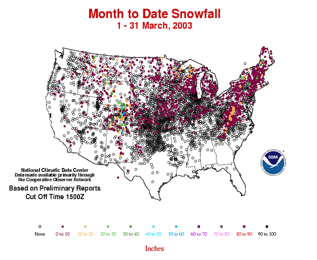
The image to the left shows the percent of average seasonal snow fall for stations across the continental U.S. Data is based on preliminary reports, final values will likely change for some stations. Many of the stations were more than 40% below average across much the West. Stations in the eastern U.S. received a greater percentage of their seasonal snow fall as of April 3rd, with some stations recording over twice the seasonal average. The tracks of several winter storms are visible (from paths of stations registering above average seasonal totals), such as a swath from northeastern Oklahoma through Missouri and Illinois to Indiana. |
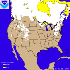
| The image to the right shows the snow cover on March 31st 2003, after a snowstorm left up to 15 inches (38.1 cm) of snow over portions of the Northeast and Mid-Atlantic. Pennsylvania received between 5 - 10 inches (12.7 - 25.4 cm) of snow, while West Virginia and southwestern Virginia received 5 -15 inches (12.7 -38.1 cm). This storm also left up to 6 inches (15.2 cm) across the mountains of the Southeast (eg. Asheville, NC and surrounding area). Click on the image to the right for an animation of snowcover throughout the month of March. |
 |
 Larger AVI Loop (5.0MB) |
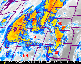
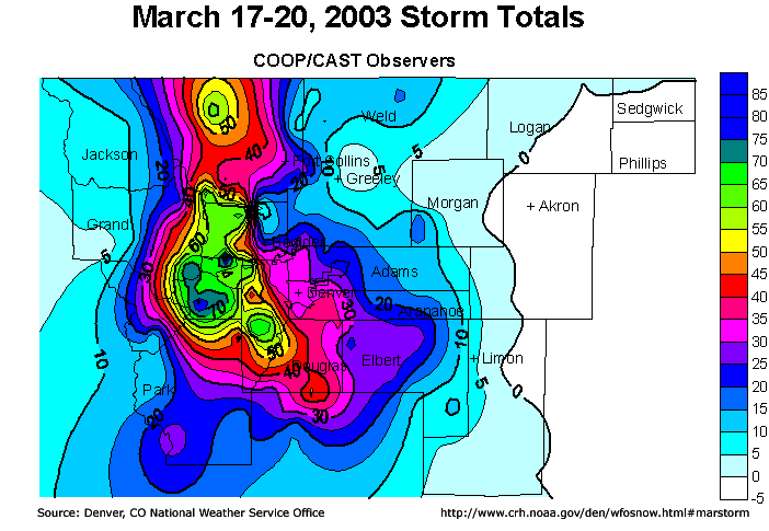
A winter storm brought significant accumulations of snow to parts of Colorado on March 17-19. Snowfall accumulations of 30 to 40 inches (76.2 - 101.6cm) were common across the Denver area. Some of the heaviest snow fell in Gilpin county, just west of Denver, where up to 87.5 inches (222cm) of snow fell. For more information on this event, contact the Denver, CO National Weather Service home page. |