With nearly 80 percent of the world’s oceans unexplored and unmapped, an international collaboration is underway to facilitate the complete mapping of the ocean floor by 2030. The General Bathymetric Chart of Oceans (GEBCO) is partnering with the Nippon Foundation (NF) to bring together all bathymetric data to produce the definitive map of the world ocean floor by 2030.
The Nippon Foundation-GEBCO Seabed 2030 Project, launched at the United Nations Ocean Conference in New York on June 6, 2017, is aligned with the UN's Sustainable Development Goal #14 to conserve and sustainably use the oceans, seas, and marine resources.
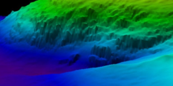
Studying our Seafloors
The ocean floor has the same general characteristics as the above-water areas of the world, including mountains, plains, channels, canyons, hills, volcanoes, and more. Most of these intriguing ecosystems have rarely been seen or explored. Yet, despite the multitude of data that have been collected over the last two hundred years, only approximately twenty percent of the world’s ocean depths have been measured with direct observation and shared with the global community (GEBCO_2021). The rest of the data used to compile seafloor maps are estimated depths largely derived from satellite gravity measurements, which can miss significant features and provide only coarse-resolution depictions of the largest seamounts, ridges, and canyons.
Bathymetry underpins the safe, sustainable, cost-effective execution of nearly every human activity at sea. Scientists create bathymetric maps and products to illustrate the depth and shapes of underwater terrain, just as topographical maps represent three-dimensional features of above-sea terrain.
Knowing the depth and shape of the seafloor is fundamental for understanding tides, tsunami inundation forecasting, fishing resources, ocean exploration, cultural heritage, environmental change, underwater hazards, infrastructure construction and maintenance, cable and pipeline routing, and much more. For example, knowledge of the seafloor’s shape is crucial for understanding ocean circulation patterns relating to regional and global ocean–atmosphere processes that distribute heat between the tropics and the poles—a key component of Earth’s climate system.
Partners in Ocean Mapping
Operating under the joint sponsorship of the International Hydrographic Organization (IHO) and the Intergovernmental Oceanographic Commission (IOC), Seabed 2030 is taking responsibility for bringing depth data together, identifying the unmapped gaps, and helping coordinate efforts by working with the established ocean mapping community. The ongoing IHO Crowdsourced Bathymetry initiative, which NOAA actively participates in, will play an important role in Seabed 2030 by continuing to encourage fishing, recreational, and commercial vessels worldwide to submit data collected using standard navigation instruments.
The video, “Beneath the Surface: Exploring Our Global Seafloor,” captures the passion of the global community dedicated to this mission and provides important context for the goal of mapping the entirety of Earth’s ocean.

Mapping the ocean floor is vital to understanding and influencing ocean attributes.
Jennifer Jencks, NCEI scientist, is featured in the video. “NCEI has hosted the IHO Data Centre for Digital Bathymetry for over 30 years,” said Jencks. “As the recognized archive for global bathymetric data, we value our role in this international effort to map our world’s ocean by continuing to steward and provide access to the world’s bathymetric data.”
NOAA committed to furthering the ongoing international cooperation known as Seabed 2030 in June 2022. NOAA Administrator Rick Spinrad signed a Memo of Understanding at the UN World Ocean Conference to solidify our cooperation among project partners.
 encompasses the U.S. Eastern Seaboard, Gulf of Mexico, Puerto Rico/U.S. Virgin Islands, and Hawaii.")