Memorandum of Understanding reaffirms NCEI as host of the Data Center for Digital Bathymetry

A new Memorandum of Understanding (MOU) signed by the International Hydrographic Organization (IHO) and NOAA maintains support from both organizations for the Data Center for Digital Bathymetry (DCDB). It reaffirms NCEI as the host of the DCDB and continues international cooperation in maintaining reliable, free, and open digital bathymetry data.
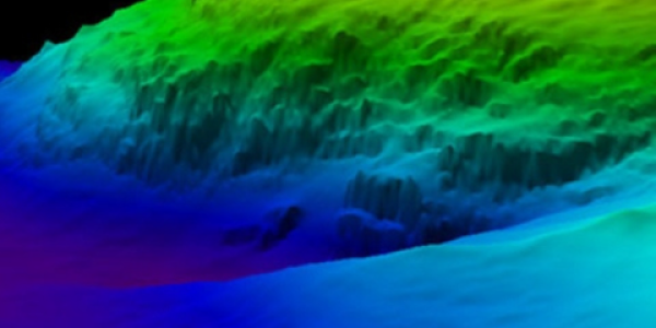
Bathymetric data includes information about the depth and shape of underwater terrain. It is used in part for the production of improved and more comprehensive bathymetric maps and grids, supporting maritime navigation safety and marine environmental conservation, among other uses. This agreement is a testament of international support for the continued study and exploration of underwater depths and the importance of making that information available.
The History of the DCDB
A United States proposal to the IHO (of which the U.S. is a member state) to host and operate the DCDB led to its founding in 1990. Since then, NOAA NCEI—formerly known as the National Geophysical Data Center, a predecessor data center to NCEI—has played host to the DCDB.
DCDB holdings include single beam and multibeam sonar data collected by vessels from all sectors, including more than 30 compressed terabytes of oceanic depth soundings.
Beginning in 2014, the DCDB also began to include crowdsourced bathymetry data, acknowledging that there was still a massive need to “map the gaps” and that the need for seafloor mapping could not be met by traditional research vessels alone. The DCDB accepts crowdsourced bathymetry data through “Trust Nodes,” or agencies, companies, and universities that act as liaisons between mariners and the DCDB.
The DCDB at NCEI
NOAA NCEI currently hosts the IHO DCDB, an arrangement which has been reaffirmed by the new MOU. This means that NCEI provides long-term archive and data management services for the IHO’s international digital bathymetry data, providing it freely and without restriction via the IHO DCDB Viewer.
The DCDB also serves as the archive for bathymetric data from several initiatives, including the General Bathymetric Chart of the Oceans (GEBCO) Ocean Mapping Program and the Nippon Foundation-GEBCO Seabed 2030 project.
NCEI also provides numerous other bathymetry data products, and using its web infrastructure, promotes bathymetric data discovery access through a variety of tools.
Continued IHO/NOAA Partnership
Under the new MOU, NOAA/NCEI activities include continued operation of the DCDB with IHO guidance and data stewardship of bathymetric data ensuring its quality, integrity, and accessibility. NOAA/NCEI will also continue to support free and open provision of bathymetric data via a mapping interface, generation of bathymetric data holdings inventories, and the development of formats and standards to expedite the international exchange of bathymetric data.
IHO activities under the MOU include promoting the contribution of bathymetric data to the DCDB, working to identify new sources of bathymetric data for the DCDB, and using the DCDB to identify data gaps in current bathymetric data coverage. The IHO will also emphasize the relative scarcity of bathymetric data in the international science community despite a growing need for such data.
In summary, by signing the new MOU, NOAA and the IHO reaffirm their cooperation and commitment to the DCDB at NCEI and the responsible stewardship and growth of international bathymetric data.
 encompasses the U.S. Eastern Seaboard, Gulf of Mexico, Puerto Rico/U.S. Virgin Islands, and Hawaii.")