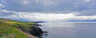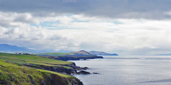
The Irish Sea’s notoriously rough waters have tested the skills of even the most advanced seafarers and have been the inspiration of poets and storytellers for hundreds of years. Also known as the Mann Sea, Manx Sea, and Celtic Sea, this body of water separates the islands of Ireland and Great Britain. What lies beneath the surface of these waters had been mostly unknown, but thanks to an ongoing seabed mapping initiative, that’s changing.
Mapping the Irish Seabed
It is often said that we know more about the surface of the Moon than we do about our own planet’s ocean floors. About 80 percent of the world’s oceans remain unexplored and unmapped. Until somewhat recently the Irish seabed had been out of sight and relatively inaccessible to humans.
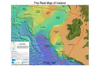
Thanks to seabed mapping, Irish researchers have developed the “Real Map of Ireland.” This map shows Ireland’s marine territory extending far beyond the coastline up to 220 million acres, an area more than 10 times its land mass. This is considered Ireland’s continental shelf, an extension of a country’s territorial waters where the natural land extends under the sea to the outer edge of the continental limit—usually around 200 miles beyond the coastline.
The “Real Map of Ireland” was created using seabed information gathered as part of a major program to map Ireland’s entire seabed territory. The program began in 1999 as the Irish National Seabed Survey and continues today as Integrated Mapping for the Sustainable Development of Ireland’s Marine Resource (INFOMAR). It is one of the largest seabed mapping programs in the world.
Researchers generate visual maps of the Irish seabed using multibeam bathymetry data.
The data from the seabed mapping program is made publicly available through the International Hydrographic Organization Data Center for Digital Bathymetry (DCDB), which NCEI hosts. It serves as the global data repository for publicly available bathymetry of the world’s oceans, seas, and coastal waters. Additionally, since 2003, INFOMAR has contributed more than 8 terabytes of high-resolution multibeam bathymetry data to this repository. That’s roughly the equivalent of 2 million photos!
Mapping and studying the ocean floor is vital to understanding and influencing ocean characteristics such as storm surges and tsunami propagation, currents and tidal flows, safe navigation, defining national and international boundaries, and the impact of sea level rise.
Ocean Mapping Is an International Affair
Mapping the Irish Sea is only one part of a much larger goal to chart the entire ocean floor. The Galway Statement on Atlantic Ocean Cooperation, signed in 2013 by the European Union, Canada, and the United States, aims to better understand the North Atlantic Ocean, promote sustainable management of its resources and advance citizens’ understanding of the region through ocean literacy.
One focus of the Galway Statement has been a collaborative seafloor mapping effort, which has resulted in a multinational working group made up of American, European, and Canadian ocean charting and bathymetry data experts.
Twenty-one of these surveys have been onboard Ireland's national research vessel, the RV Celtic Explorer. These surveys have revealed previously uncharted features on the Atlantic seabed including mountains and ridges taller than Carrauntoohil, Ireland's highest mountain. They’ve also discovered additional features such as iceberg scarred seabed from the last glaciation that ended approximately 11,000 years ago, ancient glacial moraine features, and buried sediment channels.
INFOMAR’s contribution of bathymetry data to the DCDB also supports the global mapping initiative called the Seabed 2030 Project. Seabed 2030 is a collaborative effort between the Nippon Foundation of Japan and the General Bathymetric Chart of the Oceans (GEBCO) and aims to bring all available bathymetric data together to produce a definitive and open-sourced map of our ocean floor by the year 2030. The project was launched at the United Nations (UN) Ocean Conference in June 2017 and is aligned with the UN's Sustainable Development Goal #14 to conserve and sustainably use the oceans, seas and marine resources. Every bit of data helps, and INFOMAR has set a great example for other countries to collect and furnish their data.
To access this data and learn more, visit the IHO Data Center for Digital Bathymetry.


