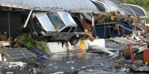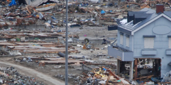
In the early evening of September 1, 1992, a deadly tsunami struck the Pacific coast of Nicaragua and northern Costa Rica, triggered by a nearby earthquake. The earthquake and tsunami left at least 170 people dead, approximately 500 injured, and more than 13,500 homeless. The tsunami caused most of the damage. Waves reached a maximum of 10 meters (32.8 feet) high, sweeping away houses, boats, vehicles, and anything else in their path. The total damage was estimated at $20 to $30 million (in 1992 dollars).
Although the initial earthquake was only about 100 kilometers (62 miles) from the coast, only about half the coastal residents felt the ground shake. In fact, following the earthquake, the National Oceanic and Atmospheric Administration (NOAA) Pacific Tsunami Warning Center (PTWC) did not issue a tsunami warning because the earthquake’s initial surface-wave magnitude (Ms) was only 6.8 and lower than their warning threshold. However, further analysis of seismic signatures would later show that the earthquake’s moment magnitude (Mw), a better representation of the total energy radiated by the earthquake, was 7.7.
A Tsunami Earthquake
In a typical earthquake-tsunami sequence, communities near the source feel the earthquake and, if properly alerted to their hazards, brace for the possibility of a tsunami. But the 1992 Nicaragua earthquake did not follow this typical pattern.
Scientists first proposed the term “tsunami earthquakes” in Japan in 1972. In such earthquakes, fault rupture occurs more slowly and gradually than it normally would during a typical earthquake. Measurements of just the short-period seismic waves will not adequately capture this slow release of energy, so a tsunami triggered by such an earthquake is larger and runs up higher than one would expect from quick calculations of Ms.
Before 1992, no one had observed seismograms where a tsunami earthquake had unfolded or developed methods for quickly calculating a reliable magnitude for them. The 1992 earthquake in Nicaragua changed that. It was the first tsunami earthquake ever recorded by broadband seismometers.
The First International Tsunami Survey Team
The unusual earthquake source characteristics of the tsunami earthquake led to the development of the first International Tsunami Survey Team (ITST). Scientists and engineers from Japan and the United States, aided by local Nicaraguan scientists and engineers, surveyed the impacted areas within three weeks of the event to document the tsunami’s effects. Due to Japan’s long history of tsunami events, the Japanese researchers were able to provide extensive post-tsunami survey experience and leadership to this team.
The first ITST focused on collecting water height, maximum inundation, and runup data. Today, post-tsunami surveys regularly survey geologic effects (e.g., deposits and erosion) of tsunamis. Social scientists, economists, ecologists, and engineers are now commonly involved in ITSTs. In addition, scientists gather eyewitness accounts from those who remember tsunamis that occurred in their childhoods, before modern instrumentation. All these efforts help communities better understand their long-term hazards.
Adapted from: Arcos, N., Dunbar, P., Stroker, K., and Kong, L. (2017), The legacy of the 1992 Nicaragua tsunami, Eos, 98, https://doi.org/10.1029/2017EO080845. Published on 30 August 2017.


