Data for Decisions

In this installment highlighting the 40th anniversary of the Regional Climate Center (RCC) Program, we focus on the Applied Climate Information System (ACIS). This system, which simplifies climate data management, delivery, and analysis, is the backbone of numerous products and services that the RCC Program provides. ACIS has greatly evolved from the original form that was conceptualized in the early 1990s and continues to progress in order to better meet user needs.
What is ACIS?
ACIS was developed and is maintained by the NOAA RCCs to manage the complex flow of climate information. It alleviates the burden of climate information management and provides data and information in accessible forms for decision-making, research, and outreach. ACIS combines historical climate information and near real-time data into one system, merging them into products for assessing climate trends, informing operational decisions, and achieving a multitude of other climate activities.
The Origin Story
In the early days of the RCC Program, when the digitization of weather and climate data was in its relative infancy, each center had its own local data storage system that largely consisted of climate data for the specific regions they served. The data contained within these systems was often a combination of near-real time data from various sources and data that were hand key-entered from paper forms. For users in need of local or regional data that fell within a particular RCC region, this model worked well. However, data retrieval became more challenging for those looking for data on a national level or for regions that crossed RCC boundaries, especially as the volume of available data rapidly increased.
This challenge was turned into an opportunity by RCC leadership, who began formulating an internet-based integrated climate data system that would allow for the seamless exchange of climate data, as well as tools to analyze and explore that data, across the six RCCs. The earliest documentation of this system dates back to 1994 and early 1995, when RCC leadership and software developers began scoping the technology needed to design and build this system.
Coincidentally, not long after this, the United States Department of Agriculture’s Natural Resources Conservation Service (USDA NRCS) inquired with the RCCs about developing a system to manage and distribute their own climate data. These ideas were merged and, in 1995, the Unified Climate Access Network (UCAN), as ACIS was originally known, was born.
UCAN: Climate Information Now for the Next Century
Phil Pasteris, formerly with the USDA NRCS and one of the primary visionaries of UCAN/ACIS, noted that, “The concept of linking climate applications directly to online climate datasets, the Unified Climate Access Network (UCAN), was conceived at the birth of the internet in 1995. The principal purpose of the UCAN project [was] to provide the NRCS with a complete climate database for use by computer models that provide products for proper natural resource management.”
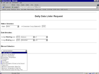
Weather and climate information may seem ubiquitous today, especially with the advent of the smartphone, but this was not the case in the mid-1990s. At that time, no system like UCAN had ever been created, and few people really knew the full potential of the internet. As such, many organizations across the country were interested in UCAN and became involved in its conceptualization, development, and testing. The USDA NRCS, for instance, provided the six RCCs with base funding to develop UCAN, and an organizational structure was established to guide development. The original software development team that included Kevin Robbins (SRCC), Claudia Perot (NRCS/WCC), Bill Noon (NRCC), David Wilensky (SRCC), Dave Barthel (SERCC), Greg McCurdy (WRCC), Carl Lonnquist (MRCC), and Jim Hines (HPRCC) was instrumental in conceptualizing and coding the earliest versions of UCAN (affiliations circa 1997).
By about 2000, the operational use of UCAN had taken hold at the Northeast and High Plains RCCs, with other centers rapidly following suit. It was soon apparent that UCAN should be expanded and improved by adding new local and regional datasets, interfacing with the National Climatic Data Center’s Climate Data Online (NCDC CDO), and synchronizing datasets between the RCCs and NCDC (NCDC was one of the organizations which merged in 2015 to form NCEI). These upgrades were substantial enough that UCAN was rebranded as the Applied Climate Information System (ACIS).
The Cloud Before the Cloud: Powered by ACIS
This first version of ACIS helped fuel a proliferation of climate data tools and resources. In the early and mid-2000s, popular products that were “Powered by ACIS”—including the ACIS Climate Summary Maps, NOWData, and VegDRI—were released. CLIMPER and an early version of cli-MATE soon followed, and ACIS-based tools began to be developed outside of the RCC Program, particularly by state climate offices and researchers.
One major advantage to using ACIS for product development is that the system is rarely down. ACIS is not run on just one server—it is a distributed data delivery system composed of several synchronized servers. These servers have been housed at multiple centers throughout the years, ensuring that there is no single point of failure. From a user perspective, data access and delivery are seamless as different servers respond to requests. The RCCs are now looking towards moving all services to the cloud to ensure continued uninterrupted delivery of climate data to meet user needs.
While UCAN/ACIS was integral to increasing the accessibility of useful and usable climate information, some of the initial methods for gathering data or creating tools using ACIS were complex, and the RCCs went back to the drawing board in an effort to enhance and streamline these processes.
|
Before ACIS was developed, the process of gathering and integrating climate datasets was often an arduous and time-consuming task. Because there was no centralized source for climate data, users had to download datasets from each individual network, format the datasets, quality control the datasets, and ensure consistent units. For those needing a constant data stream, this required a significant time commitment. ACIS helps streamline this process by providing access to multiple datasets in a common format, which allows users to focus more on research or applications, rather than data management. Tools built with ACIS can help you address questions such as:
|
ACIS Today and in the Future
ACIS has grown significantly over the years and now provides data from multiple sources to users all across the U.S. and around the world. With data available from GHCN-D and ASOS, as well as 16 daily, hourly, or sub-hourly real-time networks, four real-time grids, and 50 climate projections, users can quickly and efficiently access and analyze climate data and information for numerous applications. In fact, ACIS consistently handles more than 1.5 million data requests every single day.
All of this is possible through the latest version of ACIS called ACIS Web Services (ACIS-WS), which offers users a more streamlined and efficient approach to data retrieval. Users can submit simple web calls directly through a browser, or they can incorporate more complex calls into their own code. With ACIS-WS, a number of calculations can be performed on the ACIS servers prior to retrieval, saving users precious time and resources.
Although station-based datasets have traditionally been the most popular, there has been growing interest in the real-time gridded datasets and climate projections that are available in ACIS. Similar analyses that can be performed on the ACIS servers with station-based data can also be performed with the grids and projections. While powerful in and of itself, this capability pales in comparison to the opportunities for spatial analysis. Any grid or projection may be summarized, on the fly, to the county, climate division, basin, or state level using ACIS-WS.
This remains an active area of development for the RCC Program, and enhanced functionality, along with new sector-specific tools that utilize these grids and projections are on the horizon. New datasets are also routinely being added. In the near-term, be on the lookout for new ways to access and utilize hourly data!
This fall, the NRCC will be hosting an ACIS-WS training webinar series. To learn more about this opportunity, or about ACIS in general, please contact us.
Learn More About Your Regional Climate Center
- High Plains Regional Climate Center, University of Nebraska-Lincoln, Lincoln, NE
- Midwestern Regional Climate Center, Purdue University, West Lafayette, IN
- Northeast Regional Climate Center, Cornell University, Ithaca, NY
- Southeast Regional Climate Center, University of North Carolina at Chapel Hill, Chapel Hill, NC
- Southern Regional Climate Center, Texas A&M University, College Station, TX
- Western Regional Climate Center, Desert Research Institute, Reno, NV
NCEI’s Regional Climate Services
The RCCs are supported by the National Centers for Environmental Information (NCEI) as part of a three-tiered approach to climate services, which includes state, regional, and national partners. The RCCs work alongside six Regional Climate Services Directors that, together, comprise NCEI’s Regional Climate Services.


