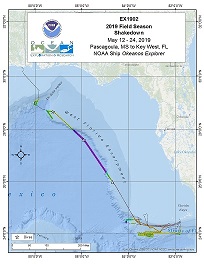
2019 Field Season Shakedown
Vessel: NOAA Ship Okeanos Explorer; Expedition Dates: May 12, 2019 to May 24, 2019
Ports: Pascagoula, MS to Key West, FL
Project Principals: Shannon Hoy, NOAA/OAR/OER (Co-Expedition Coordinator); Derek Sowers, NOAA/OAR/OER (Co-Expedition Coordinator and Mapping Lead)

This shakedown mission, which began in Pascagoula, Mississippi on May 12, 2019 and concluded on May 24, 2019 in Key West, Florida, came after the winter scheduled drydock and dockside shipyard repair period. While underway, 24-hour operations focused on preparing deep-sea mapping and water column sonars and remotely operated vehicle (ROV) systems for the remainder of 2019 expeditions. Three "engineering dives" were conducted during the first part of the expedition. The dives allowed members of the Global Foundation for Ocean Exploration to calibrate the ROV's ultra short baseline (USBL) positioning system, test a new suction sampling device, test on-ship data transfer and telepresence systems, and train new team members. As the dives focused on testing new equipment, no physical samples were collected for later analyses. During the third ROV dive on May 16, while conducting an "engineering dive" to test new remotely operated vehicle (ROV) equipment, the team made an unexpected – and exciting – discovery: the wreck of what is likely a mid-19th century wooden sailing vessel. Mapping shakedown operations during the expedition included calibrating the ship's EM302 multibeam sonar (used to map the seafloor and water column) and the EK60 split-beam sonar (used to explore the water column), integrating and calibrating a new Simrad EK80 split-beam sonar (for further water column exploration), and installing and testing a new sonar synchronization unit (K-Sync – to reduce potential interference between different sonars).
Expedition Data and Resources
| Expedition Summary Report (PDF - 3.78 MB) | Open | Click to open link |
| Mapping Summary Report (PDF - 1.59 MB) | Open | Click to open link |
| Ship Navigation Data (ASCII) | Download | Use zip utility to open file |
| Ship SCS/Sensor Data (ASCII) | Download | Use zip utility to open file |
| Ship SCS/Sensor Data (NetCDF) | Open | NetCDF file format: Special software needed to read |
| Shipboard CTDs | Download | Use zip utility to open file |
| Mapping Products | Download | Use zip utility to open file |
| GIS Products | Download | Use zip utility to open file |
Submersible Data and Resources
| Dive Tracks | Download | Use zip utility to open file |
| ROV Dive Event Logs | Open | Click to open link |
| Cruise Video Collection Self-Service Portal | Open | Click to open link |
| Submersible Navigation/Sensor Data (ASCII) | Download | Use zip utility to open file |
Collected Specimen Repositories
| Smithsonian National Museum of Natural History (Biological Samples) | Open | Click to visit repository website |
| Oregon State University's Marine Geology Repository | Open | Click to visit repository website |
Educational Resources
| Education Materials Collection | Open | Click to open Education Materials |
Publication Resources
| NOAA Central Library OER Bibliography | Open | Click to open OER Bibliography |
Links to Archived Data and Resources
| Multibeam Archive Collection | Get Data | Click to Access Archive |
| Water Column Sonar Archive Collection | Get Data | Click to Access Archive |
| Single-beam and Sub-bottom Data Archive Collection | Get Data | Click to Access Archive |
| Physical, Chemical, and Biological Archive Collection | Get Data | Click to Access Archive |
| Expedition Metadata | Open | Click to view Metadata in xml format |
Gulf of Mexico

Area
Gulf of Mexico; Test Area
Overview
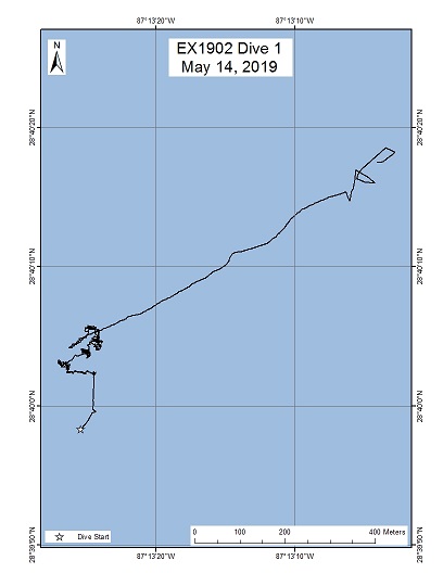
| Date: | May 14, 2019 |
| Max Depth: | 1019 Meters |
| Bottom Time: | 3 Hours 42 Minutes 0 Seconds |
Purpose
Test winter upgrades and maintenance to D2 and Seirios. Test new suction sampler. Test new Pilot/Copilot joyboxes. Train on new systems and continue to train new pilots/copilots.
Download & View Files
| Dive Track (KML - 68 KB) | View/Download | Requires Google Earth or equivalent client to view the Dive Track |
| ROV Ancillary Data (Zip - 1.91 MB) | Download | Link takes you to a public FTP server |
| Camera Platform Sensor Data (Zip - 11.9 MB) | Download | Link takes you to a public FTP server |
| Low-Resolution Video Clips (Zip - 14.3 GB) | Download | Link takes you to a public FTP server |
| Underwater Still Images (Zip - 36.2 MB) | Download | Link takes you to a public FTP server |
| Dive Video Collection Self-Service Portal | Open | Link takes you to an online video discovery and access tool |
Gulf of Mexico

Area
Gulf of Mexico; Restricted
Overview
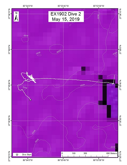
| Date: | May 15, 2019 |
| Max Depth: | 3233 Meters |
| Bottom Time: | 4 Hours 25 Minutes 0 Seconds |
Purpose
Deep dive to test all systems at higher ocean pressure and verify proper operation. Test winter upgrades and maintenance to D2 and Seirios. Test new suction sampler. Test new Pilot/Copilot joyboxes. Train on new systems and continue to train new pilots/copilots.
Download & View Files
| Dive Track (KML - 68.9 KB) | View/Download | Requires Google Earth or equivalent client to view the Dive Track |
| ROV Ancillary Data (Zip - 2.95 MB) | Download | Link takes you to a public FTP server |
| Camera Platform Sensor Data (Zip - 18.1 MB) | Download | Link takes you to a public FTP server |
| Low-Resolution Video Clips (Zip - 23.3 GB) | Download | Link takes you to a public FTP server |
| Underwater Still Images (Zip - 52.5 MB) | Download | Link takes you to a public FTP server |
| Dive Video Collection Self-Service Portal | Open | Link takes you to an online video discovery and access tool |
Gulf of Mexico

Area
Gulf of Mexico; Test Area
Overview
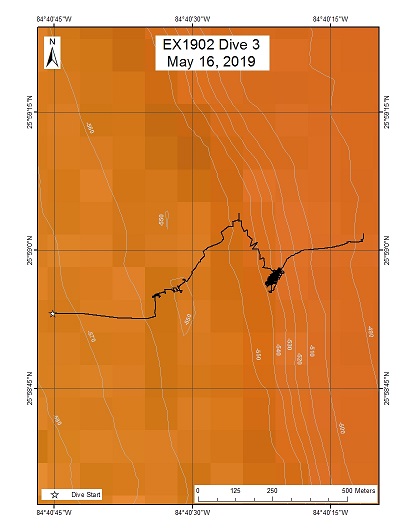
| Date: | May 16, 2019 |
| Max Depth: | 547 Meters |
| Bottom Time: | 10 Hours 5 Minutes 0 Seconds |
Purpose
Continued testing of winter upgrades and maintenance to D2 and Seirios. Test new suction sampler. Test new Pilot/Copilot joyboxes. Train on new systems and continue to train new pilots/copilots. Practice "standard operational mode" to mimic typical dive operations (waypoints, sampling, high-quality imaging).
Download & View Files
| Dive Track (KML - 66.4 KB) | View/Download | Requires Google Earth or equivalent client to view the Dive Track |
| ROV Ancillary Data (Zip - 1.68 MB) | Download | Link takes you to a public FTP server |
| Camera Platform Sensor Data (Zip - 22.8 MB) | Download | Link takes you to a public FTP server |
| Low-Resolution Video Clips (Zip - 30.8 GB) | Download | Link takes you to a public FTP server |
| Underwater Still Images (Zip - 136 MB) | Download | Link takes you to a public FTP server |
| Dive Video Collection Self-Service Portal | Open | Link takes you to an online video discovery and access tool |

