
Okeanos Explorer (EX1606): CAPSTONE Wake Island Unit PRIMNM (ROV & Mapping)
Vessel: NOAA Ship Okeanos Explorer; Expedition Dates: July 27 - August 19, 2016
Project Principals: Brian Kennedy, NOAA/OAR/OER (Expedition Coordinator); Lindsay McKenna, NOAA/OAR/OER (Mapping Lead)
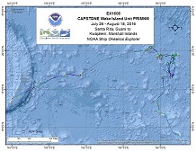
Operations will use the ship's deep water mapping systems (Kongsberg EM302 multibeam sonar, EK60 split-beam fisheries sonars, ADCPs, and Knudsen 3260 chirp sub-bottom profiler sonar), NOAA's two-body 6000 m remotely operated vehicle (ROVs Deep Discoverer and Seirios), CTD rosette, and the ship's high-bandwidth satellite connection for real-time ship to shore communications. Daytime ROV dives are planned most days from July 28 - August 16th and a few dedicated mapping transit days are also expected. ROV dives will include high-resolution visual surveys and limited rock and biologic specimen sampling. Mapping operations will be conducted overnight and when the ROV is on deck. CTD casts may be requested during the cruise to collect more environmental information at sites of interest.
Expedition Data and Resources
| Ship Navigation Data (ASCII) | Download | Use zip utility to open file |
| Ship SCS/Sensor Data (ASCII) | Download | Use zip utility to open file |
| Ship SCS/Sensor Data (NetCDF) | Open | NetCDF file format: Special software needed to read |
| Shipboard CTDs | Download | Use zip utility to open file |
| Mapping Products | Download | Use zip utility to open file |
| GIS Products | Download | Use zip utility to open file |
Submersible Data and Resources
| Dive Track KMLs | Download | Use zip utility to open file |
| Event Logs | Open | Click to open link |
| Cruise Video Collection Self-Service Portal | Open | Click to open link |
| Submersible Navigation/Sensor Data (ASCII) | Download | Use zip utility to open file |
Educational Resources
| Expedition Education Module | Open | Click to open Education Module |
| Lesson Plans (K-12) | Open | Click to open Lesson Plans |
| Education Materials Collection | Open | Click to open Education Materials |
Links to Archived Data and Resources
| Multibeam Archive Collection | Get Data | Click to Access Archive |
| Water Column Sonar Archive Collection | Get Data | Click to Access Archive |
| Trackline Data (Single-beam and Sub-bottom) | Get Data | Click to Access Archive |
| Physical, Chemical, and Biological Archive Collection | Get Data | Click to Access Archive |
| Collection of Documents | Get Data | Click to Access Archive |
| Expedition Metadata | Open | Click to view Metadata in xml format |
Alba Seamount in Russian Federation Mn Crust Lease Block 65
Area
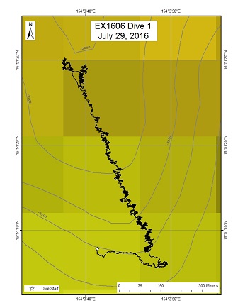
Alba Seamount in Russian Federation Mn Crust Lease Block 65; North Pacific Ocean; Areas between Guam and Wake and inside the Wake Unit of the Pacific Remote Islands Marine National Monument
Overview
| Date: | July 29, 2016 |
| Max Depth: | 2319.1 Meters |
| Bottom Time: | 5 Hours 33 Minutes 17 Seconds |
Purpose
This dive was conducted in Cobalt-Rich Ferromanganese Crust Exploration block 65 granted to the Government of the Russian Federation by the International Seabed Authority (ISA). The objective of the dive was to survey an actual Mn-crust lease block for the presence of deep water coral and sponge communities that could be impacted by mining operations in the future. A second aspect of this dive lies in the geology of the seamount. This seamount is one of the rare seamounts that was previously dredged for geological samples. The technique of dredging has very limited depth resolution, and carefully sampled rocks from this seamount will allow geologists to place existing data within a framework of volcanic construction.
Download & View Files
| Dive Summary Report (PDF - 991 KB) | View/Download | Requires Adobe Acrobat Reader to view the Dive Summary Report |
| Dive Track (KML - 117 KB) | View/Download | Requires Google Earth or equivalent client to view the Dive Track |
| ROV Ancillary Data (Zip - 1.41 MB) | Download | Link takes you to a public FTP server |
| ROV CTD/Sensor Data (Zip - 5.01 MB) | Download | Link takes you to a public FTP server |
| Camera Platform Sensor Data (Zip - 4.66 MB) | Download | Link takes you to a public FTP server |
| Low-Resolution Video Clips (Zip - 4.94 GB) | Download | Link takes you to a public FTP server |
| Underwater Still Images (Zip - 93.6 MB) | Download | Link takes you to a public FTP server |
| Dive Video Collection Self-Service Portal | Open | Link takes you to an online video discovery and access tool |
Seamount #2 (unofficial name: Sampson)
Area
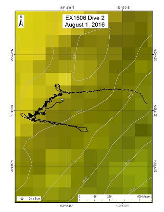
Seamount #2 (unofficial name: Sampson); North Pacific Ocean; Wake Atoll Unit of PRIMNM
Overview
| Date: | August 01, 2016 |
| Max Depth: | 2250.7 Meters |
| Bottom Time: | 2 Hours 49 Minutes 59 Seconds |
Purpose
The objective of the dive was to conduct a survey of the deepwater coral and sponge community on a ridge extending from this guyot inside the northwestern part of the Wake Monument. We expected the ridge to be Mn crusted and the goal was to increase our knowledge of the animals that are potentially at risk from deep sea mining activities in the future. Documenting Mn crust communities is a major CAPSTONE priority. A second objective of this dive is to provide data and samples for use in determining the geologic history of this seamount. This geology of the seamounts in this area of the Pacific is poorly understood, and it has never been explored or sampled before to our knowledge.
Download & View Files
| Dive Summary Report (PDF - 744 KB) | View/Download | Requires Adobe Acrobat Reader to view the Dive Summary Report |
| Dive Track (KML - 94 KB) | View/Download | Requires Google Earth or equivalent client to view the Dive Track |
| ROV Ancillary Data (Zip - 1.25 MB) | Download | Link takes you to a public FTP server |
| ROV CTD/Sensor Data (Zip - 4.79 MB) | Download | Link takes you to a public FTP server |
| Camera Platform Sensor Data (Zip - 5 MB) | Download | Link takes you to a public FTP server |
| Low-Resolution Video Clips (Zip - 3.65 GB) | Download | Link takes you to a public FTP server |
| Underwater Still Images (Zip - 53 MB) | Download | Link takes you to a public FTP server |
| Dive Video Collection Self-Service Portal | Open | Link takes you to an online video discovery and access tool |
Delilah Guyot (Seamount 3)
Area
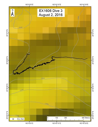
Delilah Guyot (Seamount 3); North Pacific Ocean; Wake Unit of the Pacific Remote Islands Marine National Monument
Overview
| Date: | August 02, 2016 |
| Max Depth: | 1984.4 Meters |
| Bottom Time: | 5 Hours 59 Minutes 28 Seconds |
Purpose
The purpose of the dive was to survey of the deepwater coral and sponge community on a ridge extending from Delilah guyot (Smoot, 1991) inside the northwestern part of the Wake Monument. The depth of the top of this seamount is similar to the adjacent seamounts, and fits with the expectation that it is approximately 100 Ma old (Cretaceous). The dive was planned to be entirely within the optimal depth range for the formation of Mn crusts (i.e., 1,000-2,500 m). Dense communities of deepwater corals and sponges have also been discovered at these depths and on this type of topography. The ridge was therefore expected to be Mn crusted and documenting the animals found at the site should increase our knowledge of the species that are potentially at risk from deep sea mining activities in the future. Documenting Mn crust communities is furthermore a major CAPSTONE priority. Another purpose of this dive was to provide data and samples for use in determining the geologic history of this seamount. The geology of the seamounts in this area of the Pacific is poorly understood.
Download & View Files
| Dive Summary Report (PDF - 1.14 MB) | View/Download | Requires Adobe Acrobat Reader to view the Dive Summary Report |
| Dive Track (KML - 128 KB) | View/Download | Requires Google Earth or equivalent client to view the Dive Track |
| ROV Ancillary Data (Zip - 1.6 MB) | Download | Link takes you to a public FTP server |
| ROV CTD/Sensor Data (Zip - 5.08 MB) | Download | Link takes you to a public FTP server |
| Camera Platform Sensor Data (Zip - 4.89 MB) | Download | Link takes you to a public FTP server |
| Low-Resolution Video Clips (Zip - 5.88 GB) | Download | Link takes you to a public FTP server |
| Underwater Still Images (Zip - 143 MB) | Download | Link takes you to a public FTP server |
| Dive Video Collection Self-Service Portal | Open | Link takes you to an online video discovery and access tool |
McDonnell Guyot
Area
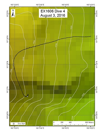
McDonnell Guyot; North Pacific Ocean; Wake Atoll unit of PRIMNM
Overview
| Date: | August 03, 2016 |
| Max Depth: | 766 Meters |
| Bottom Time: | n/a |
Purpose
Before the ROV reached bottom the ship lost power and the dive was aborted.
Download & View Files
| Dive Summary Report (PDF - 191 KB) | View/Download | Requires Adobe Acrobat Reader to view the Dive Summary Report |
| Dive Track (KML - 19 KB) | View/Download | Requires Google Earth or equivalent client to view the Dive Track |
| ROV Ancillary Data (Zip - 277 KB) | Download | Link takes you to a public FTP server |
| ROV CTD/Sensor Data (Zip - 1.15 MB) | Download | Link takes you to a public FTP server |
| Camera Platform Sensor Data (Zip - 1.34 MB) | Download | Link takes you to a public FTP server |
| Low-Resolution Video Clips (Zip - 680 MB) | Download | Link takes you to a public FTP server |
| Underwater Still Images (Zip - 5.32 MB) | Download | Link takes you to a public FTP server |
| Dive Video Collection Self-Service Portal | Open | Link takes you to an online video discovery and access tool |
McDonnell Guyot West
Area
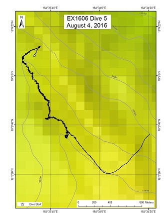
McDonnell Guyot West; North Pacific Ocean; Wake Atoll unit of PRIMNM
Overview
| Date: | August 04, 2016 |
| Max Depth: | 2582.4 Meters |
| Bottom Time: | 7 Hours 4 Minutes 53 Seconds |
Purpose
The objective of the dive is to conduct a survey of the deepwater coral and sponge community on a ridge extending north from McDonnell guyot unofficially named McDonnell (Smoot, 1991). in the Wake Monument at depths just below the optimal range for Mn crust formation. The densest communities of deepwater corals and sponges have been discovered above 2500m and on this type of topography. Due to its approximate age, judged from similarities to seamounts further north that were age-dated, the ridge was therefore expected to be Mn crusted and documenting the environmental limits for animals found at the site should increase our knowledge of the species that are potentially at risk from deep sea mining activities in the future. Documenting Mn crust communities is a major CAPSTONE priority and determining the lower depth limit of these communities is important. A second objective of this dive was to provide data and samples for use in determining the geologic history of this seamount. This geology of the seamounts in this area of the Pacific is poorly understood. The dive start and end points were at 2603 m and 2507 m.
Download & View Files
| Dive Summary Report (PDF - 1.21 MB) | View/Download | Requires Adobe Acrobat Reader to view the Dive Summary Report |
| Dive Track (KML - 108 KB) | View/Download | Requires Google Earth or equivalent client to view the Dive Track |
| ROV Ancillary Data (Zip - 1.75 MB) | Download | Link takes you to a public FTP server |
| ROV CTD/Sensor Data (Zip - 6.03 MB) | Download | Link takes you to a public FTP server |
| Camera Platform Sensor Data (Zip - 5.64 MB) | Download | Link takes you to a public FTP server |
| Low-Resolution Video Clips (Zip - 5.91 GB) | Download | Link takes you to a public FTP server |
| Underwater Still Images (Zip - 117 MB) | Download | Link takes you to a public FTP server |
| Dive Video Collection Self-Service Portal | Open | Link takes you to an online video discovery and access tool |
Unnamed Guyot
Area
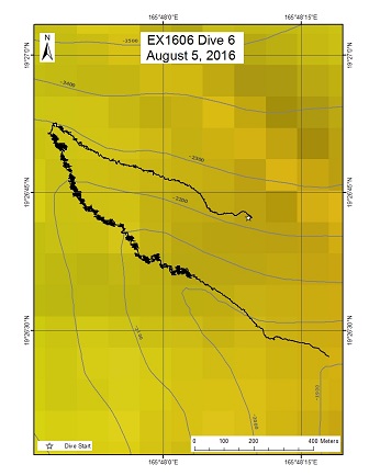
Unnamed Guyot; North Pacific Ocean; Wake Unit of the Pacific Remote Islands Marine National Monument
Overview
| Date: | August 05, 2016 |
| Max Depth: | 2230.1 Meters |
| Bottom Time: | 5 Hours 10 Minutes 13 Seconds |
Purpose
The purpose of the dive was to survey of the deepwater coral and sponge community on a ridge extending to the north-northwest from an unnamed guyot, 60 miles west of Wake Islands, inside the Wake Monument. The dive was planned to examine a shallower depth range compared to the previous dive, on a similar ridge (in terms of its condition). We chose a depth range of approximately ~2250-1950m, shallower than the 2500m limit above which we expect the densest communities of deepwater corals. The age of the seamount is likely to be just short of 100 Ma, judged from similarities to seamounts further north that were age-dated. Therefore, a significant coating of Mn is expected. This location allows us to document the environmental limits for animals found at the site, and this should increase our knowledge of the species that are potentially at risk from deep sea mining activities in the future. Documenting Mn crust communities is furthermore a major CAPSTONE priority. Another purpose of this dive was to provide data and samples for use in determining the geologic history of this seamount. The geology of the seamounts in this area of the Pacific is poorly understood.
Download & View Files
| Dive Summary Report (PDF - 1.13 MB) | View/Download | Requires Adobe Acrobat Reader to view the Dive Summary Report |
| Dive Track (KML - 105 KB) | View/Download | Requires Google Earth or equivalent client to view the Dive Track |
| ROV Ancillary Data (Zip - 1.56 MB) | Download | Link takes you to a public FTP server |
| ROV CTD/Sensor Data (Zip - 4.8 MB) | Download | Link takes you to a public FTP server |
| Camera Platform Sensor Data (Zip - 4.66 MB) | Download | Link takes you to a public FTP server |
| Low-Resolution Video Clips (Zip - 4.44 GB) | Download | Link takes you to a public FTP server |
| Underwater Still Images (Zip - 88 MB) | Download | Link takes you to a public FTP server |
| Dive Video Collection Self-Service Portal | Open | Link takes you to an online video discovery and access tool |
Lafayette Guyot (unofficial name)
Area
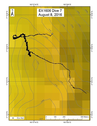
Lafayette Guyot (unofficial name); North Pacific Ocean; Wake Atoll unit of PRIMNM
Overview
| Date: | August 08, 2016 |
| Max Depth: | 2089.9 Meters |
| Bottom Time: | 5 Hours 30 Minutes 57 Seconds |
Purpose
This dive is one of two proposed to explore a ridge extending from the northwest side of an unnamed seamount that we unofficially dubbed Lafayette guyot. The dive explored a depth range that typically hosts diverse coral and sponge communities. The goal of the dive was to carefully image the fauna, including multiple representatives of the same species, to provide insights into their natural history (including evidence for recent recruitment, reproductive status, aberrant growth), associates and predators. During the 2015 field season dives, many examples of coral predation and several examples of unusual colony growth (particularly among bamboo corals) were observed, but these types of observations were uncommon during this year's dives in the Marianas. What pattern will be seen in this intermediate geographic area? This proposed dive track began at 2090 m, below the crest of the ridge; the dive track then climbed the western-facing slope to the crest where it turned south following the crest line toward a local topographic high point at ~1898 m. The proposers were more interested in detailed observations of the fauna along this track rather than reaching the topographic high. The dive was in the Pacific Remote Islands Marine National Monument and the results will provide information valuable to the NOAA Marine National Monuments Program and NOAA's Deep Sea Coral and Technology Program (DSCTP).
Download & View Files
| Dive Summary Report (PDF - 1.08 MB) | View/Download | Requires Adobe Acrobat Reader to view the Dive Summary Report |
| Dive Track (KML - 96 KB) | View/Download | Requires Google Earth or equivalent client to view the Dive Track |
| ROV Ancillary Data (Zip - 1.54 MB) | Download | Link takes you to a public FTP server |
| ROV CTD/Sensor Data (Zip - 5.27 MB) | Download | Link takes you to a public FTP server |
| Camera Platform Sensor Data (Zip - 5.16 MB) | Download | Link takes you to a public FTP server |
| Low-Resolution Video Clips (Zip - 4.36 GB) | Download | Link takes you to a public FTP server |
| Underwater Still Images (Zip - 88.6 MB) | Download | Link takes you to a public FTP server |
| Dive Video Collection Self-Service Portal | Open | Link takes you to an online video discovery and access tool |
North side of Wake Island (#7)
Area
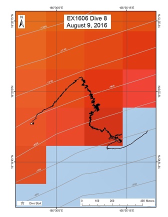
North side of Wake Island (#7); North Pacific Ocean; Wake Atoll unit of the PRIMNM
Overview
| Date: | August 09, 2016 |
| Max Depth: | 1034.3 Meters |
| Bottom Time: | 5 Hours 9 Minutes 12 Seconds |
Purpose
This was the first of two shallower dives targeting the precious coral resources and fishes around Wake Island. Nothing is known about the present of commercially valuable species of coralliids, isidids, antipatharians, and parazoanthids, nor even about the deeper fish species inhabiting the island slope. While no species in any of the coral families are known to have been harvested off Wake Island, precious corals are a fishery across the Pacific under the responsibility of NOAA Fisheries and therefore additional information on their distribution and abundance in any of the US EEZs is valuable for improving their management. These data are also important to the Deep Sea Coral Research and Technology Program. The objective of this dive is therefore to survey for corals, particularly precious corals, off Wake Island with the secondary objective of documenting the deeper fish community on the slopes. Our initial intent was to begin at a depth of 600 m and transect up from there as shallow as possible, potentially up to 250 m. However, the slope is so steep in that depth range that survey those depths would have put the ship too close to the reef. We therefore modified the plan to begin at just over 1,000 m and transect up to between 500-600 m.
Download & View Files
| Dive Summary Report (PDF - 1.11 MB) | View/Download | Requires Adobe Acrobat Reader to view the Dive Summary Report |
| Dive Track (KML - 161 KB) | View/Download | Requires Google Earth or equivalent client to view the Dive Track |
| ROV Ancillary Data (Zip - 1.55 MB) | Download | Link takes you to a public FTP server |
| ROV CTD/Sensor Data (Zip - 4.4 MB) | Download | Link takes you to a public FTP server |
| Camera Platform Sensor Data (Zip - 4.52 MB) | Download | Link takes you to a public FTP server |
| Low-Resolution Video Clips (Zip - 3.75 GB) | Download | Link takes you to a public FTP server |
| Underwater Still Images (Zip - 121 MB) | Download | Link takes you to a public FTP server |
| Dive Video Collection Self-Service Portal | Open | Link takes you to an online video discovery and access tool |
Amakasu Maru No.1 Wreck Site
Area
Amakasu Maru No.1 Wreck Site; North Pacific Ocean; Wake Atoll Unit of the PRIMNM
Overview
| Date: | August 10, 2016 |
| Max Depth: | n/a |
| Bottom Time: | 8 Hours 49 Minutes 7 Seconds |
Purpose
The purpose of this dive was to groundtruch a target extracted from multibeam sonar believed to be the wreck of the Japanese destroyer Hayate sunk during the battle of Wake. If the target turned out to be the Hayate, then the objectives were to complete a preliminary characterization of the wreck that would confirm its identity, record its condition, document battle damage, and record the marine communities on the site. This characterization would include 1) locating the major sections and determine or confirm the vessel broke apart, 2) complete a transit around the perimeter to record diagnostic features (guns, torpedo tubes, depth charges, superstructure, stacks and elements of the hull) that will aid a positive identification, 3) carefully record battle damage and its extent, 4) assess the overall condition and state of preservation, and 5) note the marine biological communities associated with the wreck. If the target turned out to be a different wreck, then the characterization above would still be carried out and if time remained, 2 additional backup targets would be investigated to see if they could be the Hayate.
Download & View Files
| Dive Summary Report (PDF - 543 KB) | View/Download | Requires Adobe Acrobat Reader to view the Dive Summary Report |
| Dive Video Collection Self-Service Portal | Open | Link takes you to an online video discovery and access tool |
Un-named guyot south of Wake Island
Area
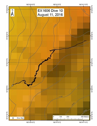
Un-named guyot south of Wake Island; North Pacific Ocean; Wake Atoll Unit of the PRIMNM
Overview
| Date: | August 11, 2016 |
| Max Depth: | 1514.5 Meters |
| Bottom Time: | 6 Hours 23 Minutes 32 Seconds |
Purpose
The objective of the dive was similar to other dives conducted on guyot rift zone ridges and was to survey the deepwater coral and sponge community in the depth range for Mn crust formation. The survey aimed to increase our knowledge of the animals that are potentially at risk from deep sea mining activities in the future and documenting Mn crust communities is a major CAPSTONE priority. A second objective of this dive was to provide data and samples for use in determining the geologic history of this seamount. This geology of the seamounts in this area of the Pacific is poorly understood. The dive start and end points were a bit shallower than most of our previous guyot dives being 1500 m and 1400 m, respectively, to specifically investigate this depth range on an otherwise similar feature (southwestern rift zone off a guyot).
Download & View Files
| Dive Summary Report (PDF - 1.24 MB) | View/Download | Requires Adobe Acrobat Reader to view the Dive Summary Report |
| Dive Track (KML - 163 KB) | View/Download | Requires Google Earth or equivalent client to view the Dive Track |
| ROV Ancillary Data (Zip - 1.72 MB) | Download | Link takes you to a public FTP server |
| ROV CTD/Sensor Data (Zip - 5.05 MB) | Download | Link takes you to a public FTP server |
| Camera Platform Sensor Data (Zip - 4.79 MB) | Download | Link takes you to a public FTP server |
| Low-Resolution Video Clips (Zip - 4.18 GB) | Download | Link takes you to a public FTP server |
| Underwater Still Images (Zip - 97.9 MB) | Download | Link takes you to a public FTP server |
| Dive Video Collection Self-Service Portal | Open | Link takes you to an online video discovery and access tool |
E Wake Island
Area
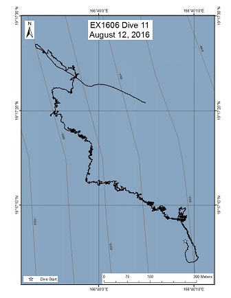
E Wake Island; North Pacific Ocean; Wake Atoll Unit of the PRIMNM
Overview
| Date: | August 12, 2016 |
| Max Depth: | 639.4 Meters |
| Bottom Time: | 6 Hours 49 Minutes 52 Seconds |
Purpose
This was the second of two shallower dives targeting the precious coral resources around Wake Island. Since nothing was known about the presence of commercially valuable species of coralliids, isidids, antipatharians, and parazoanthids, the shallow water dives were planned to target the habitats of these animals. While no species in any of these families are known to have been harvested off Wake Island, precious corals are a fishery across the Pacific under the responsibility of NOAA Fisheries and therefore additional information on their distribution and abundance in any of the US EEZs is valuable for improving their management. These data are also important to the Deep Sea Coral Research and Technology Program. The objective of this dive was therefore to survey for corals, particularly precious corals, off Wake Island. In addition, the shallow(er) water dives were also aimed at characterizing the fish population in the monument.
Download & View Files
| Dive Summary Report (PDF - 989 KB) | View/Download | Requires Adobe Acrobat Reader to view the Dive Summary Report |
| Dive Track (KML - 228 KB) | View/Download | Requires Google Earth or equivalent client to view the Dive Track |
| ROV Ancillary Data (Zip - 1.47 MB) | Download | Link takes you to a public FTP server |
| ROV CTD/Sensor Data (Zip - 5.29 MB) | Download | Link takes you to a public FTP server |
| Camera Platform Sensor Data (Zip - 5.07 MB) | Download | Link takes you to a public FTP server |
| Low-Resolution Video Clips (Zip - 4.45 GB) | Download | Link takes you to a public FTP server |
| Underwater Still Images (Zip - 100 MB) | Download | Link takes you to a public FTP server |
| Dive Video Collection Self-Service Portal | Open | Link takes you to an online video discovery and access tool |
Revolver Seamount (unofficial name)
Area
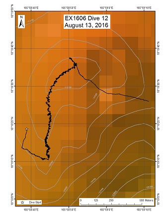
Revolver Seamount (unofficial name); North Pacific Ocean; Wake Atoll Unit of the PRIMNM
Overview
| Date: | August 13, 2016 |
| Max Depth: | 1266.6 Meters |
| Bottom Time: | 6 Hours 32 Minutes 33 Seconds |
Purpose
The guyot is located approximately 70 miles southwest of Wake Island and was unofficially dubbed Revolver Seamount, for its appearance on a multibeam map. The objective of the dive was to survey a volcanic cone located on the flat summit of the seamount. The current thinking is that these could have formed as a result of rejuvenated volcanism (after the seamount formed a coral reef on top). This dive should provide data and samples for use in determining the geologic history of this seamount, which is unknown, as is the geologic history of most seamounts in this area of the Pacific. Often, corals and sponges prefer topographic highs, which these cones represent. The cone selected for the dive site is open on the east side forming ridges on the south and north sides. The ROV will survey up the south ridge of the cone for deepwater corals and sponges. This dive is one of the shallowest dives on a guyot in the monument since the track is above the main flat summit. The dive start and end points are at 1269 m and 1150 m.
Download & View Files
| Dive Summary Report (PDF - 1.08 MB) | View/Download | Requires Adobe Acrobat Reader to view the Dive Summary Report |
| Dive Track (KML - 179 KB) | View/Download | Requires Google Earth or equivalent client to view the Dive Track |
| ROV Ancillary Data (Zip - 1.56 MB) | Download | Link takes you to a public FTP server |
| ROV CTD/Sensor Data (Zip - 5.05 MB) | Download | Link takes you to a public FTP server |
| Camera Platform Sensor Data (Zip - 4.8 MB) | Download | Link takes you to a public FTP server |
| Low-Resolution Video Clips (Zip - 4.24 GB) | Download | Link takes you to a public FTP server |
| Underwater Still Images (Zip - 151 MB) | Download | Link takes you to a public FTP server |
| Dive Video Collection Self-Service Portal | Open | Link takes you to an online video discovery and access tool |
Unnamed Guyot ( nicknamed Batfish Guyot)
Area
Unnamed Guyot ( nicknamed Batfish Guyot); North Pacific Ocean; Wake Atoll Unit of the PRIMNM
Overview
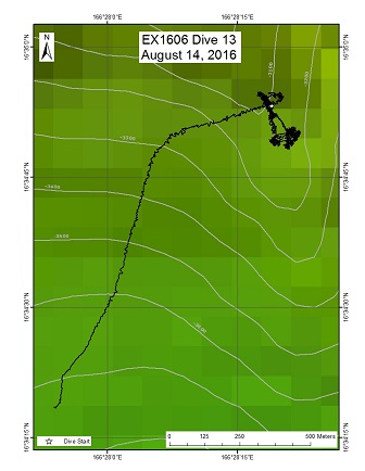
| Date: | August 14, 2016 |
| Max Depth: | 3135.5 Meters |
| Bottom Time: | 1 Hours 27 Minutes 11 Seconds |
Purpose
The dive plan targeted a seamount located ~189 miles south of Wake Island, and near the southern boundary of the monument. We have named the seamount "Batfish" for its appearance on the map. The dive was situated on the southeasterly ridge around 3100m, and was intended to progress upward along the ridge crest. The objective of the dive was similar to other dives conducted on guyot rift zone ridges, namely to survey the deepwater coral and sponge communities. This dive differed from the other ridge dives in being deeper than the optimal depth range for Mn crust formation. Furthermore, the intent of the dive was to understand the maximum depth range for high density communities, which we believe is between 2500-3000 m. The final objective of this dive was to provide data and samples for use in determining the geologic history of this seamount. This geology of the seamounts in this area of the Pacific is poorly understood. The dive plan start and end points were at 3109m and 2818 m.
Download & View Files
| Dive Summary Report (PDF - 1.1 MB) | View/Download | Requires Adobe Acrobat Reader to view the Dive Summary Report |
| Dive Track (KML - 63 KB) | View/Download | Requires Google Earth or equivalent client to view the Dive Track |
| ROV Ancillary Data (Zip - 1.49 MB) | Download | Link takes you to a public FTP server |
| ROV CTD/Sensor Data (Zip - 4.44 MB) | Download | Link takes you to a public FTP server |
| Camera Platform Sensor Data (Zip - 4.38 MB) | Download | Link takes you to a public FTP server |
| Low-Resolution Video Clips (Zip - 1.73 GB) | Download | Link takes you to a public FTP server |
| Underwater Still Images (Zip - 53.2 MB) | Download | Link takes you to a public FTP server |
| Dive Video Collection Self-Service Portal | Open | Link takes you to an online video discovery and access tool |
Last Dive Guyot (Unofficial name)
Area
Last Dive Guyot (Unofficial name); North Pacific Ocean; Wake Atoll Unit of the PRIMNM
Overview
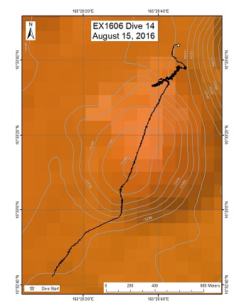
| Date: | August 15, 2016 |
| Max Depth: | 1283.9 Meters |
| Bottom Time: | 3 Hours 30 Minutes 5 Seconds |
Purpose
The objective of the dive was to survey an un-named guyot and in particular a curious mound shaped feature that may or may not be volcanic in origin. If it turned out to be volcanic, then it could have formed as a result of rejuvenated volcanism. The ROV planned track was to begin the benthic part of the dive on the flat guyot summit next to the feature then move to it and up its flank until it reached the top. The animal focus was the same as most of the previous dives: deep water corals, sponges, and fishes, as well as other animals encountered. This dive was one of the shallowest dives on a guyot in the monument since most of the planned track was above the main flat summit. We hoped this dive would also provide data and samples for use in determining the geologic history of this seamount.
Download & View Files
| Dive Summary Report (PDF - 990 KB) | View/Download | Requires Adobe Acrobat Reader to view the Dive Summary Report |
| Dive Track (KML - 138 KB) | View/Download | Requires Google Earth or equivalent client to view the Dive Track |
| ROV Ancillary Data (Zip - 1.36 MB) | Download | Link takes you to a public FTP server |
| ROV CTD/Sensor Data (Zip - 4.11 MB) | Download | Link takes you to a public FTP server |
| Camera Platform Sensor Data (Zip - 4.23 MB) | Download | Link takes you to a public FTP server |
| Low-Resolution Video Clips (Zip - 3.15 GB) | Download | Link takes you to a public FTP server |
| Underwater Still Images (Zip - 70.3 MB) | Download | Link takes you to a public FTP server |
| Dive Video Collection Self-Service Portal | Open | Link takes you to an online video discovery and access tool |

