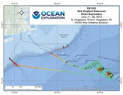
Okeanos Explorer (EX1303): New England Seamount Chain Exploration
Vessel: NOAA Ship Okeanos Explorer; Expedition Dates: June 11 - 29, 2013
Project Principals: Adam Skarke, NOAA/OAR/OER (Expedition Coordinator and Mapping Lead)

Transit mapping operations will collect bathymetric, water column backscatter, seafloor backscatter data, and sub-bottom profile data.
Expedition Data and Resources
| Mapping Products | Download | Use zip utility to open file |
| Shipboard CTDs | Download | Use zip utility to open file |
| Ship Navigation Data (ASCII) | Download | Use zip utility to open file |
| Ship SCS/Sensor Data (ASCII) | Download | Use zip utility to open file |
| Ship SCS/Sensor Data (NetCDF) | Open | NetCDF file format: Special software needed to read |
Educational Resources
| Education Materials Collection | Open | Click to open Education Materials |
Links to Archived Data and Resources
| Multibeam Archive Collection | Get Data | Click to Access Archive |
| Water Column Sonar Archive Collection | Get Data | Click to Access Archive |
| Trackline Data (Single-beam and Sub-bottom) | Get Data | Click to Access Archive |
| Physical, Chemical, and Biological Archive Collection | Get Data | Click to Access Archive |
| Collection of Documents | Get Data | Click to Access Archive |
| Expedition Metadata | Open | Click to view Metadata in xml format |

