NOAA/WDS Paleoclimatology - Larson - Oxbow - PIRE - ITRDB MI029
 Paleoclimatology - Tree Ring
This archived Paleoclimatology Study is available from the NOAA National Centers for Environmental Information (NCEI), under the World Data Service (WDS) for Paleoclimatology. The associated NCEI study type is Tree Ring. The data include parameters of tree ring with a geographic location of Michigan, United States Of America. The time period coverage is from 277 to 72 in calendar years before present (BP). See metadata information for parameter and study location details. Please cite this study when using the data.
- Cite as: Larson, E.R.; Rawling, J.E. (2021-07-01): NOAA/WDS Paleoclimatology - Larson - Oxbow - PIRE - ITRDB MI029. [indicate subset used]. NOAA National Centers for Environmental Information. https://doi.org/10.25921/z2fe-2z57. Accessed [date].
- Please refer to Credit tab for full citation information.
- doi:10.25921/z2fe-2z57
- noaa-tree-33697
- NCEI DSI 1200_02
- NCEI DSI 1200_01
noaa-tree-33697
| Search Data |
|
| Download Data |
|
| Distribution Formats |
|
| Ordering Instructions | Contact NCEI for other distribution options and instructions. |
| Distributor | NOAA National Centers for Environmental Information
ncei.info@noaa.gov |
| Dataset Point of Contact | NOAA National Centers for Environmental Information
ncei.info@noaa.gov |
| Dataset Point of Contact | Data Center Contact
NOAA World Data Service for Paleoclimatology 828-271-4800 paleo@noaa.gov |
| Coverage Description | Date Range: 1673 CE to 1878 CE; Date Range: 277 cal yr BP to 72 cal yr BP; |
| Time Period | 1673 to 1878 |
| Spatial Bounding Box Coordinates |
N: 42.675565
S: 42.675565
E: -86.211856
W: -86.211856
|
| Spatial Coverage Map | |
| General Documentation |
|
| Associated Resources |
|
| Publication Dates |
|
| Data Presentation Form | Digital table - digital representation of facts or figures systematically displayed, especially in columns
|
| Dataset Progress Status | Complete - production of the data has been completed |
| Data Update Frequency | Data update frequency not available |
| Supplemental Information |
STUDY NOTES: NOAA Template Raw Measurements file added 2021-08-05.
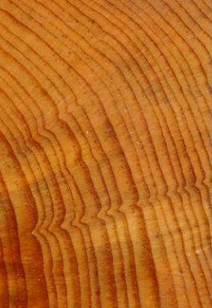
ABSTRACT SUPPLIED BY ORIGINATOR: The need to understand lake level variability in the Great Lakes is underscored by record low stands in 2012 followed by a quick shift back to the historic averages by 2014 in the Michigan-Huron basins. These rapid changes have important implications for near-shore ecology, sedimentology, water management, tourism, and industrial commerce throughout the Great Lakes region. Attempts to reconstruct climatic controls of lake level variability from tree rings have either been based on spatially and temporally limited tree-ring data sets or tree--ring records from sites in the Pacific Northwest teleconnected to Great Lakes climate. The necessary local tree-ring chronologies to develop more robust reconstructions of climate and its relation to Great Lakes levels simply do not exist. A particularly evident gap in available data exists in Lower Michigan, where logging in the 1800s removed most old growth forests. Here we report the development of three new tree-ring chronologies derived from a pier near the mouth of the Kalamazoo River that was constructed ca. 1871. The new chronologies include multi-century Pinus resinosa (1673-1878), Quercus spp. (1628-1847), and Tsuga canadensis (1643-1864) tree-ring data that exhibit patterns of correlation among reference chronologies of the same species indicative of origins within the Great Lakes Region, and possibly Lower Michigan. Our results illustrate the excellent potential to develop a more complete network of sites with tree-ring data throughout the Michigan-Huron Basin by utilizing wood incorporated into historical structures. |
| Purpose | Tree ring data from the International Tree Ring Data Bank and World Data Center for Paleoclimatology archives. Most data sets include raw treering measurements (most are annual ring width, with some collections of earlywood or latewood width or wood density), plus chronologies (standardized growth indices for a site compiled from multiple treering samples). Reconstructions of climate variables are included with some of these data sets. Each data type is stored in a separate data file; the data type is coded into the file name. For details please see: http://www.ncei.noaa.gov/products/paleoclimatology/tree-ring |
| Dataset Citation |
|
| Cited Authors |
|
| Originators |
|
| Publishers |
|
| Theme keywords | Global Change Master Directory (GCMD) Science Keywords
|
| Data Center keywords | Global Change Master Directory (GCMD) Data Center Keywords
|
| Place keywords |
|
| Use Constraints |
|
| Access Constraints |
|
| Fees |
|
Last Modified: 2023-05-22
For questions about the information on this page, please email: ncei.info@noaa.gov