NOAA GOES-R Series Extreme Ultraviolet and X-ray Irradiance Sensors (EXIS) Instrument Calibration Data

EXIS-INST-CAL-ENG

browse graphic
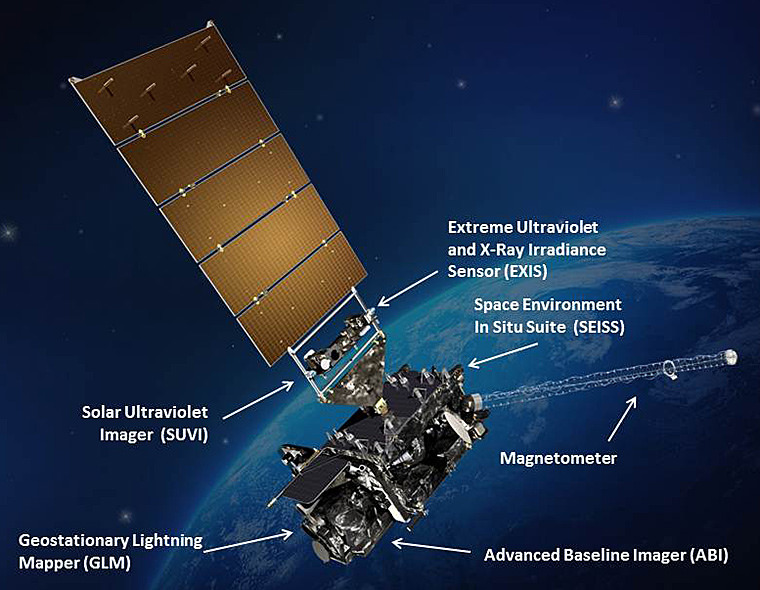
GOES-R satellite illustration
The EXIS Instrument Engineering Telemetry Data file contains data used to support the generation of EUVS and XRS Level 1b products, and monitor and evaluate the health and performance of the sensor suite. This data is transmitted to the ground in raw digital counts, and subsequently converted into physical units by the ground system. Some of the data pertains to the temperature of components in the sensor suite. This includes temperatures for the power board, interface board, operational heater, entrance slit, detectors, detector boards, microprocessor board, EUVS-C analog to digital converter, and XRS ASICs and other sub-assemblies. Other telemetry includes XRS-A and XRS-B solar minimum and maximum dark current and field of view corrections, and gains. Temperatures are expressed in units of kelvin, and the other telemetry items are in units of counts, counts per digital number, or have no units of measure. A netCDF-4 file containing this EXIS engineering telemetry is generated hourly. Telemetry parameter values are included at one second intervals, and summary statistics, including minimum, maximum, mean and standard deviation, are produced for the one hour period.
  • Cite as: GOES-R Calibration Working Group and GOES-R Series Program, (2015): NOAA GOES-R Series Extreme Ultraviolet and X-ray Irradiance Sensors (EXIS) Instrument Calibration Data. [indicate subset used]. NOAA National Centers for Environmental Information. EXIS-INST-CAL-ENG. Accessed [date].
  • gov.noaa.ncdc:C01528
  • EXIS-INST-CAL-ENG
Order Data
Distribution Formats
  • netCDF (Version: 4)
  • PDF
Ordering InstructionsContact NCEI for other distribution options and instructions.
DistributorNOAA National Centers for Environmental Information
ncei.info@noaa.gov
Dataset Point of Contact Customer Engagement Branch
NOAA National Centers for Environmental Information
1-828-271-4800
ncei.orders@noaa.gov
Time Period2015-01-01 to Present
Spatial Bounding Box Coordinates
N: 81.328
S: -81.32
E: 6.2995
W: -156.2
Spatial Coverage Map
General Documentation
Processing Documents
  • GOES-R ABI Calibration Working Group
Associated Resources
Publication Dates
  • publication: 2015-01-01
Data Presentation Form Digital table - digital representation of facts or figures systematically displayed, especially in columns
Dataset Progress StatusOngoing - data is continually being updated
Data Update Frequency Continual
PurposeThese instrument calibration data can be used to evaluate, monitor, and trend sensor performance.
Dataset Citation
  • Cite as: GOES-R Calibration Working Group and GOES-R Series Program, (2015): NOAA GOES-R Series Extreme Ultraviolet and X-ray Irradiance Sensors (EXIS) Instrument Calibration Data. [indicate subset used]. NOAA National Centers for Environmental Information. EXIS-INST-CAL-ENG. Accessed [date].
Cited Authors
  • GOES-R Calibration Working Group
  • GOES-R Series Program
Principal Investigators
  • GOES-R Calibration Working Group
Resource Providers
  • GOES-R Series Program
Publishers
  • NOAA National Centers for Environmental Information
Theme keywordsGlobal Change Master Directory (GCMD) Science Keywords
  • Earth Science > Spectral/Engineering > Infrared Wavelengths > Sensor Counts
  • Earth Science > Spectral/Engineering > Visible Wavelengths > Sensor Counts
Data Center keywordsGlobal Change Master Directory (GCMD) Data Center Keywords
  • DOC/NOAA/NESDIS/NCEI > National Centers for Environmental Information, NESDIS, NOAA, U.S. Department of Commerce
  • DOC/NOAA/NESDIS/STAR > Center for Satellite Applications and Research, NESDIS, NOAA, U.S. Department of Commerce
  • DOC/NOAA/NESDIS/OSPO > Office of Satellite and Product Operations, NESDIS, NOAA, U.S. Department of Commerce
Platform keywordsGlobal Change Master Directory (GCMD) Platform Keywords
  • GOES-16 > Geostationary Operational Environmental Satellite 16
  • GOES-17 > Geostationary Operational Environmental Satellite 17
  • GOES-18 > Geostationary Operational Environmental Satellite 18
Instrument keywordsGlobal Change Master Directory (GCMD) Instrument Keywords
  • Solar/Space Observing Instruments > Ultraviolet Instruments > EXIS-EUVS-GOESR > Extreme Ultraviolet Sensor on GOES-R Series
  • Solar/Space Observing Instruments > X-Ray/Gamma Ray Detectors > EXIS-XRS-GOESR > X-Ray Sensor on GOES-R Series
Place keywordsGlobal Change Master Directory (GCMD) Location Keywords
  • Space > Solar Region
Project keywordsGlobal Change Master Directory (GCMD) Project Keywords
  • GOES > Geostationary Operational Environmental Satellites
  • gov.noaa.class:GRIC
  • EXIS-INST-CAL-ENG
Use Constraints
  • Cite as: GOES-R Calibration Working Group and GOES-R Series Program, (2015): NOAA GOES-R Series Extreme Ultraviolet and X-ray Irradiance Sensors (EXIS) Instrument Calibration Data. [indicate subset used]. NOAA National Centers for Environmental Information. EXIS-INST-CAL-ENG. Accessed [date].
  • Use liability: NOAA and NCEI cannot provide any warranty as to the accuracy, reliability, or completeness of furnished data. Users assume responsibility to determine the usability of these data. The user is responsible for the results of any application of this data for other than its intended purpose.
Access Constraints
  • restricted
  • Distribution liability: NOAA and NCEI make no warranty, expressed or implied, regarding these data, nor does the fact of distribution constitute such a warranty. NOAA and NCEI cannot assume liability for any damages caused by any errors or omissions in these data. If appropriate, NCEI can only certify that the data it distributes are an authentic copy of the records that were accepted for inclusion in the NCEI archives.
Fees
  • In most cases, electronic downloads of the data are free. However, fees may apply for custom orders, data certifications, copies of analog materials, and data distribution on physical media.
Lineage information for: dataset
Lineage StatementThese data were produced by the NOAA Office of Satellite and Product Operations (OSPO) and are archived at the NOAA National Centers for Environmental Information (NCEI).
Processor
  • DOC/NOAA/NESDIS/OSPO > Office of Satellite and Product Operations, NESDIS, NOAA, U.S. Department of Commerce
Processing Steps
  • Extreme Ultraviolet and X-Ray Irradiance Sensors (EXIS) front-end processing starts on the spacecraft where space packets are multiplexed placing multiple packets in each transfer frame. Forward error correction (FEC) coding (Low-Density Parity Check - LDPC) occurs and the packets are downlinked. The data is received, forward error correction decode is performed. In the event of an uncorrectable error the transfer frame is discarded. Error-free space packets are then extracted from the transfer frames. EXIS science data arrives at the ground system from the spacecraft in a compressed format. The data is decompressed then packaged for delivery to external interfaces.
Processing Documents
    • GOES-R ABI Calibration Working Group
Lineage information for: repository
Processing Steps
  • 2015-04-22T00:00:00 - NOAA created the National Centers for Environmental Information (NCEI) by merging NOAA's National Climatic Data Center (NCDC), National Geophysical Data Center (NGDC), and National Oceanographic Data Center (NODC), including the National Coastal Data Development Center (NCDDC), per the Consolidated and Further Continuing Appropriations Act, 2015, Public Law 113-235. NCEI launched publicly on April 22, 2015.
Last Modified: 2023-12-13
For questions about the information on this page, please email: ncei.info@noaa.gov