Access Methods
HTTPS Access
Download ASCII versions of the GHCNh derived data from our web accessible folders. We recommend this type of access for large volumes of data.
Search Tools
GHCNh data are available via NCEI enterprise data access tools. These search tools are recommended for subsetted orders and smaller volumes of data. Not all derived products are available in these systems.
Map Tool
The map viewer tools provide access to GHCNh and derived datasets through GIS capabilities. Not all derived products are available through the map viewers.
- GHCNh (not yet available)
- Synoptic Summary of the Day (SSODv2)
- Local Climatological Data (LCD)
Web Services API
These publicly accessible web services allow users to have programmatic access to NCEI data and use custom and standard implementations such as Open Geospatial Consortium GIS Web Services (Web Map Service, Web Feature Service, Web Coverage Service) and OPeNDAP.
Not all derived products are available through web services.
API Documentation
Products
Global Hourly
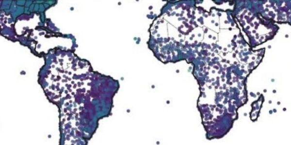
The NCEI Data Access application provides access to GHCNh. Data from more than 20,000 stations are available with subsetting and station search features available.
Synoptic Summary of the Day Version 2 (SSODv2)
Daily climate summaries are computed from the hourly and synoptic reports provided in GHCNh. These daily summaries are based on hourly (e.g. METAR/FM15) or 6-hourly (SYNOP/FM16) reports for a calendar day that runs from 00 to 23 UTC. In this way, all daily climate summaries in SSOD conform to the same synchronous 24-hour period (the same “synoptic day") worldwide. This contrasts with the daily summaries provided in Global Historical Climatology Network daily (GHCNd) dataset. In GHCNd, daily climate summaries are provided by national Met Services and are compiled according to the observation time and conventions used in their country for daily climate reports (e.g., midnight local time for US Airports, 06 UTC in Canada, 9 am local in Australia etc.)
The utility of SSOD is that daily summaries are provided in short time delay for the network of many thousands of stations that transmit hourly and synoptic reports. This ensures the SSOD summary day is consistent for all stations worldwide, making it easier to compare numerical weather prediction model outputs and remotely sensed data.
One disadvantage of SSOD is that daily precipitation totals may be underreported in the synoptic messages. Additionally, maximum and minimum temperatures gleaned from the synoptic messages also may not correspond to the true daily extremes. The daily summaries provided by national Met Services in GHCNd are therefore recommended when the most accurate reports are required for daily rainfall and maximum/minimum temperatures. However, as noted above, the 24-hour periods represented in the daily summaries provided in GHCNd are not the same worldwide. This distinction between the consistent summary day in SSOD and the mix of summary days in GHCNd is the reason for the name change from Global Summary of the Day (GSOD) to Synoptic Summary of the Day (SSOD, version 2).
When available, SSOD provides mean values of temperature, dew point temperature, sea level pressure, station pressure, visibility, and wind speed, plus maximum and minimum temperature, maximum sustained wind speed and maximum gust, precipitation amount, snow depth, and weather indicators. A complete list of data sources and parameter definitions is available in the ssod_DOCUMENTATION file.
Background
GHCNh is NCEI’s next generation hourly/synoptic dataset, replacing the Integrated Surface Dataset (ISD), which has been provided since the early 2000s. GHCNh incorporates essentially the same set of data sources as its ISD predecessor plus more than 100 additional data sources. Some of these new data inputs provide observations for only a small number of stations, whereas others provided by national Meteorology Services may provide data for hundreds or even thousands of stations. Likewise, some sources contain observations for only one to a few meteorological elements whereas others are much more comprehensive. These elements include wind speed and direction, wind gust, temperature, dew point and/or wet bulb temperature, relative humidity, cloud data, sea level and station level pressure, altimeter setting, present weather, visibility, precipitation amounts for various time periods, and snow depth. A complete list of data sources and parameter definitions is available in the ghcnh_DOCUMENTATION file.
GHCNh was developed as part of a collaboration with the Copernicus Programme and partners at Maynooth University with the aim to make historical land and marine surface weather data more easily accessible worldwide. At NCEI, GHCNh was developed to be vertically aligned with its GHCN daily counterpart (GHCNd). This means that, in general, the same GHCN identifiers are used for stations common to the daily and hourly datasets and these identifiers are managed and searchable in NCEI’s Historical Observing Metadata Repository (HOMR) database and NCEI’s Data Access applications.
Identification of Potential Data Errors
A general set of quality control checks is applied to a subset of variables after all sources are integrated into a set of unique periods of record station files. These checks are described in Dunn et al. (2016). In addition, GHCNh preserves the Quality Control information of its component sources. These flags are described in the ghcnh_DOCUMENTATION.
References
R.J.H. Dunn, R.J.H, K.M.Willett, D.E.Parker,and L. Mitchell, 2016: Geosci.Instrum.Method.Data Syst.Discuss., doi:10.5194/gi-2016-9.


